Volumes / Journal / 14 - 2003 / Bevan A., Frederick C., Krahtopoulou A.
Click on any image to open slideshow
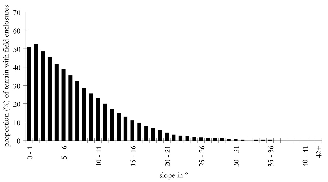
Fig. 1 – Histogram of the proportion of terrain with enclosed fields in relation...
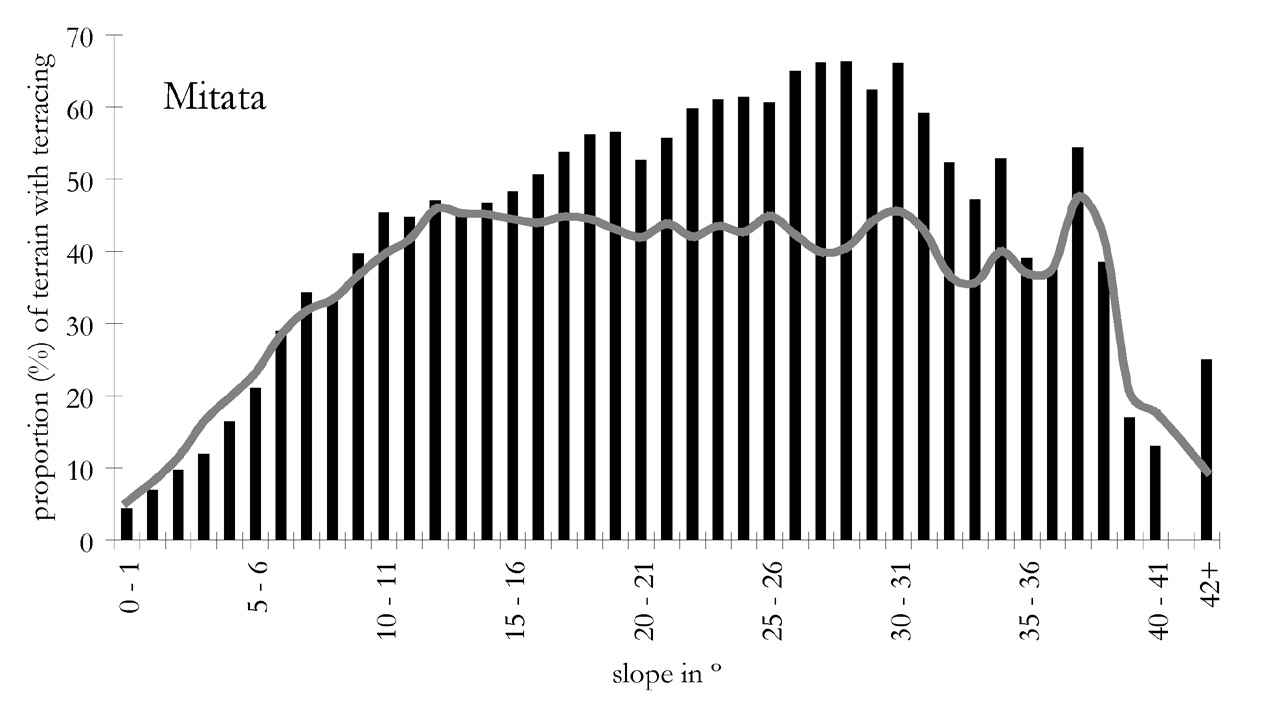
Fig. 2 – Histogram of the proportion of terrain with hillslope terraces in relat...
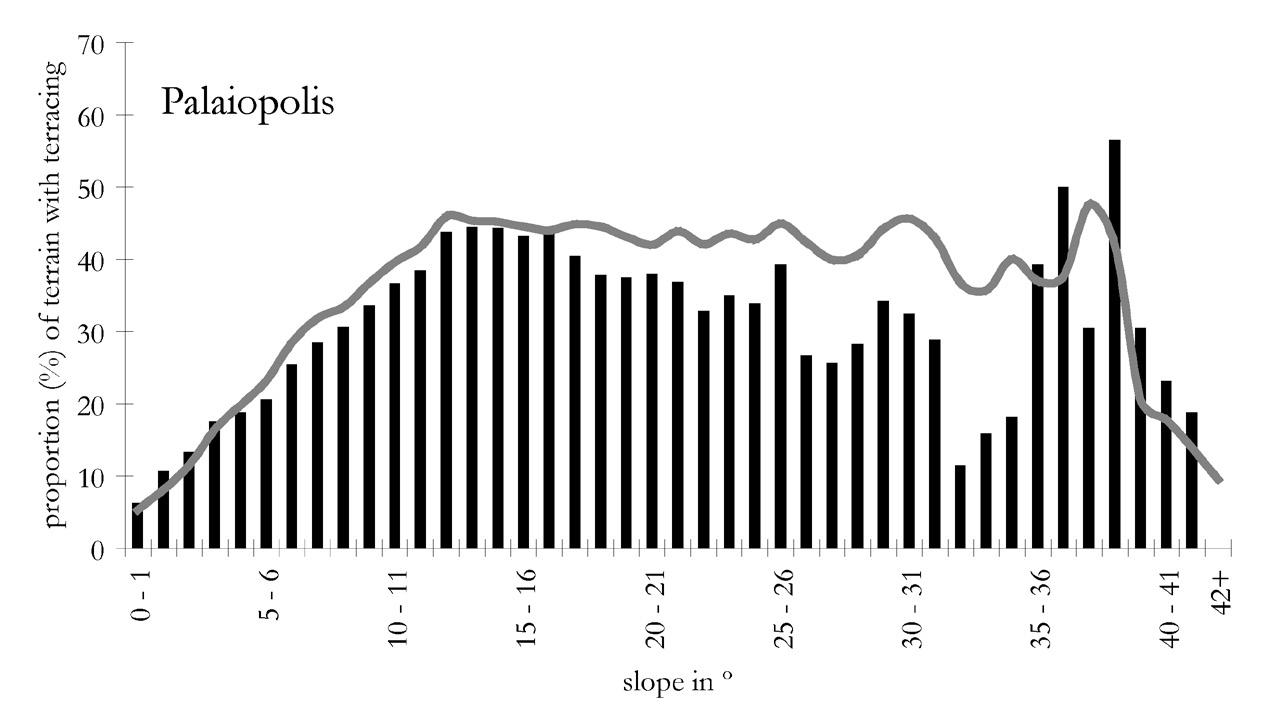
Fig. 3 – As previous Fig., but for the Palaiopolis area.
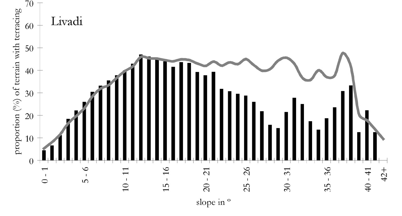
Fig. 4 – As previous Fig., but for the Livadi area.
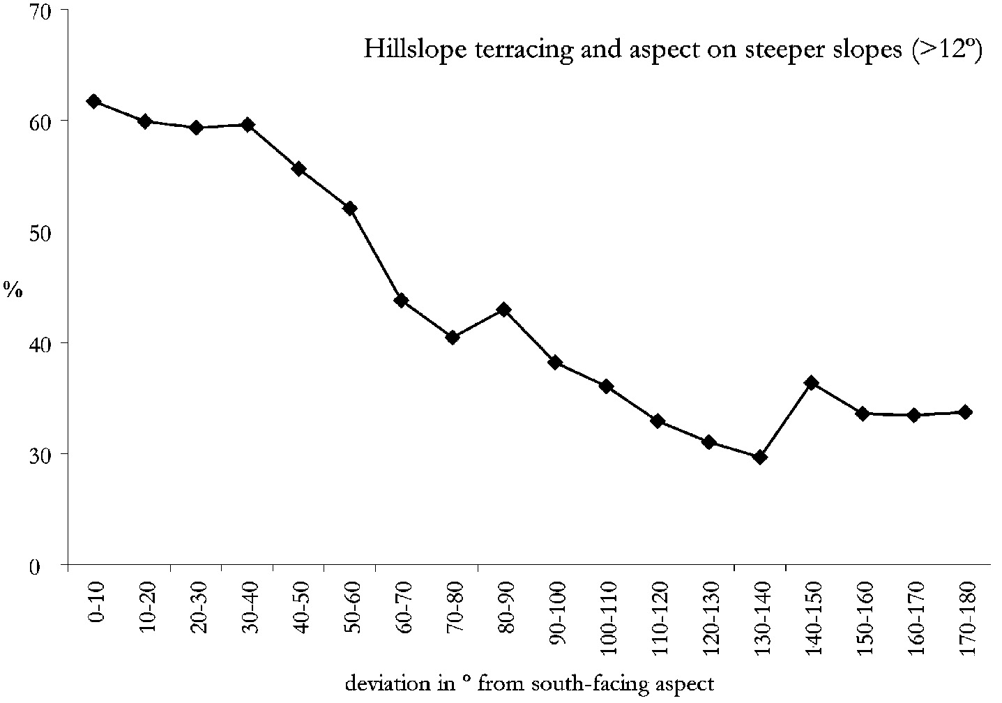
Fig. 5 – Plot of the proportion of steeper terrain (over 12º in slope) with hill...
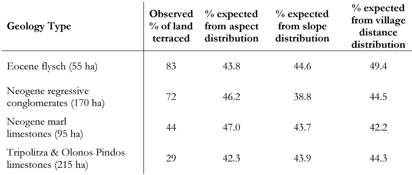
Fig. 6 – Table of the observed percentage of terracing permajor bedrock type in ...
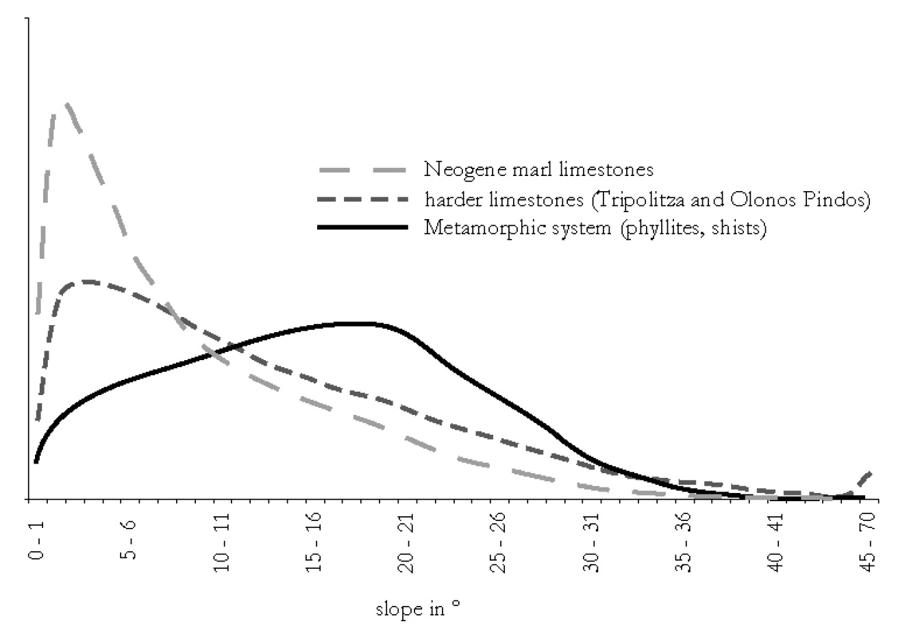
Fig. 7 – Approximate island-wide frequency distribution of slope values in relat...
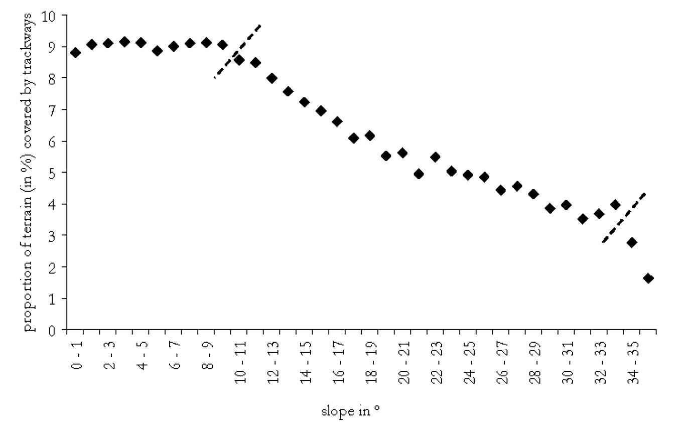
Fig. 8 – Plot of the proportion of terrain with trackways in relation to slope....
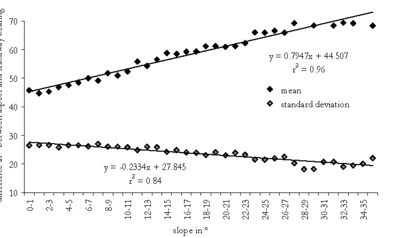
Fig. 9 – Plot of first and second order moments (mean and standard deviation) of...
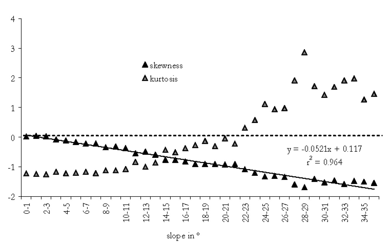
Fig. 10 – Plot of third and fourth order moments (skewness and kurtosis) of the ...
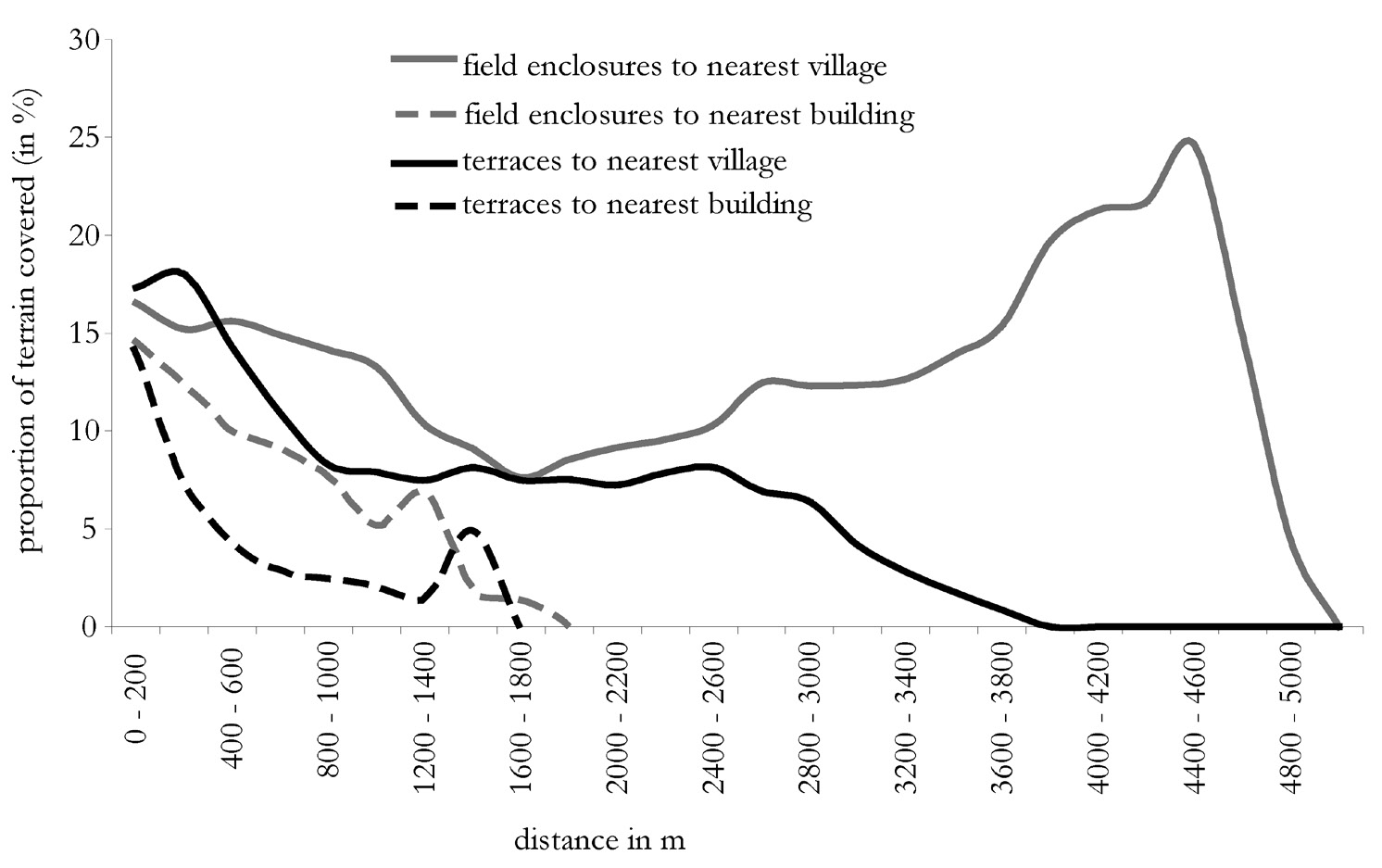
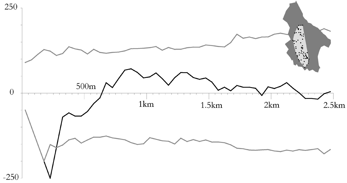
Fig. 11 – Plots of the prevalence of field systems in relation to distance to ne...
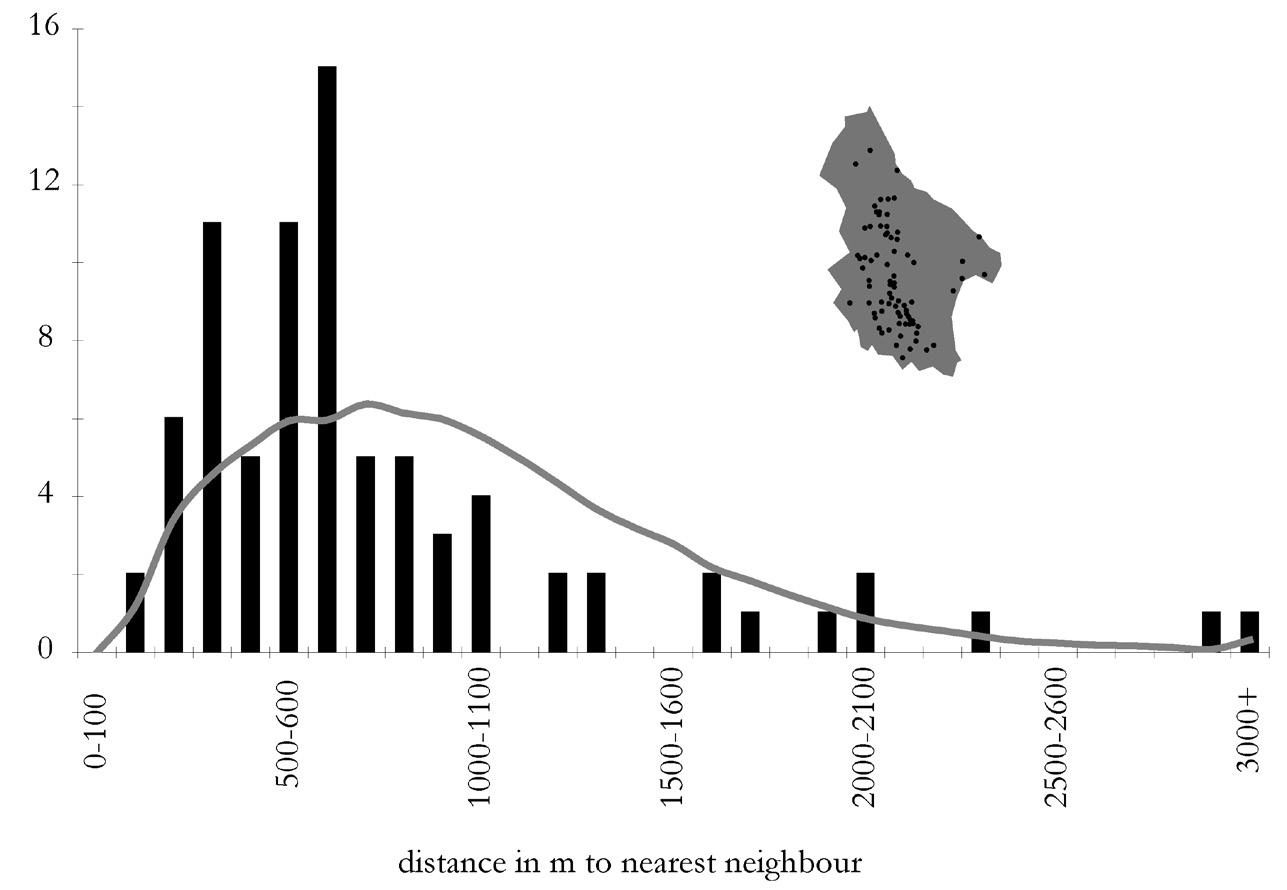
Fig. 12 – Histogram of nearest neighbour distances for Kytheran villages. The gr...
Fig. 13 – Ripley’s K as a modified function (L). The black line shows the observ...
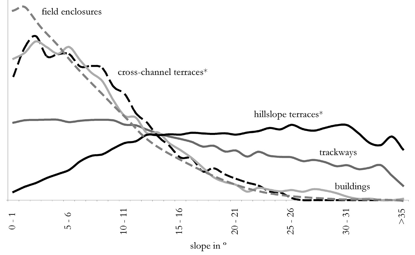
Fig. 14 – Standardised plots of the prevalence of different built structures in ...
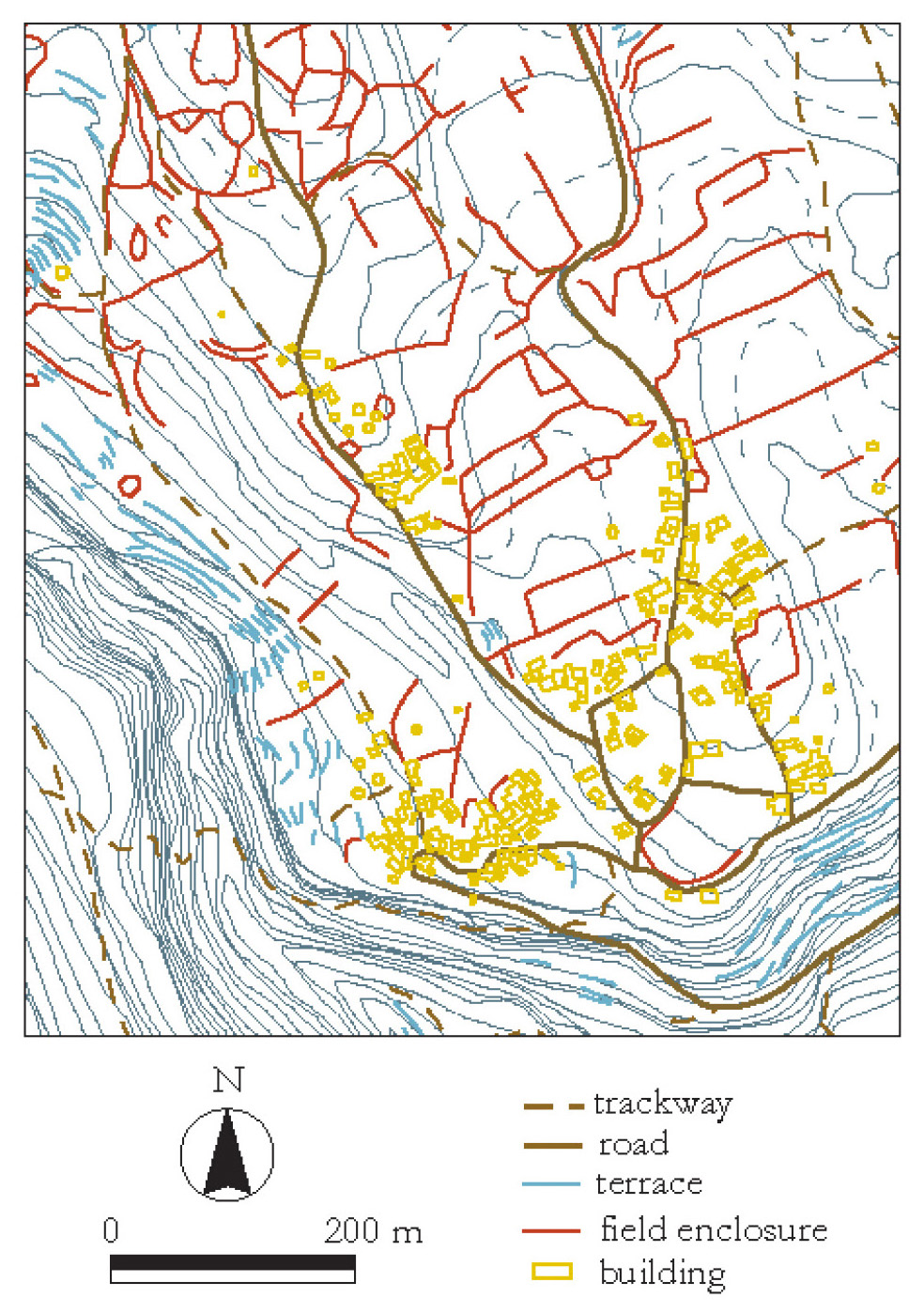
Tav. IV – a: A digitised section of the Hellenic Military Geographical Service 1...
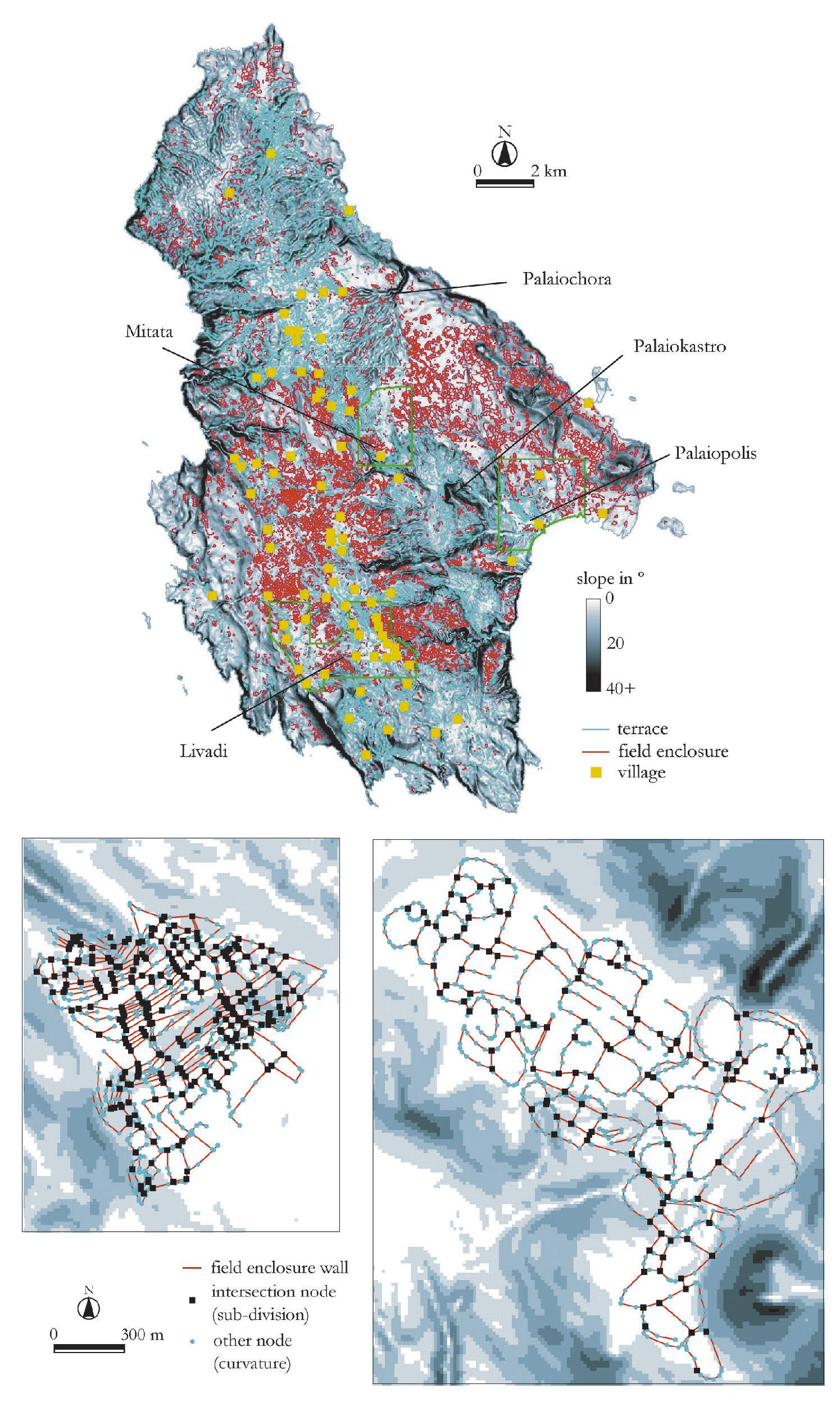
Tav. IV - b: Slope map of the island with field enclosures, terraces and village...
Bevan A., Frederick C., Krahtopoulou A. 2003, A digital Mediterranean countryside: GIS approaches to the spatial structure of the post-medieval landscape on Kythera (Greece), Archeologia e Calcolatori 14