IADI Image
Metadata
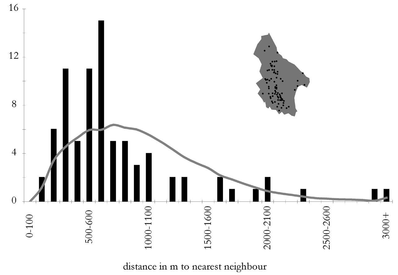
| Caption | Histogram of nearest neighbour distances for Kytheran villages. The grey line represents an expected distribution derived from 1000 random iterations. |
| Figure number | 12 |
| Article | A digital Mediterranean countryside: GIS approaches to the spatial structure of the post-medieval landscape on Kythera (Greece) |
| Authors | Bevan A., Frederick C., Krahtopoulou A. |
| Volume | Volume 14 |