Volumes / Journal / 23 - 2012 / Kovacs K. et al.
Click on any image to open slideshow
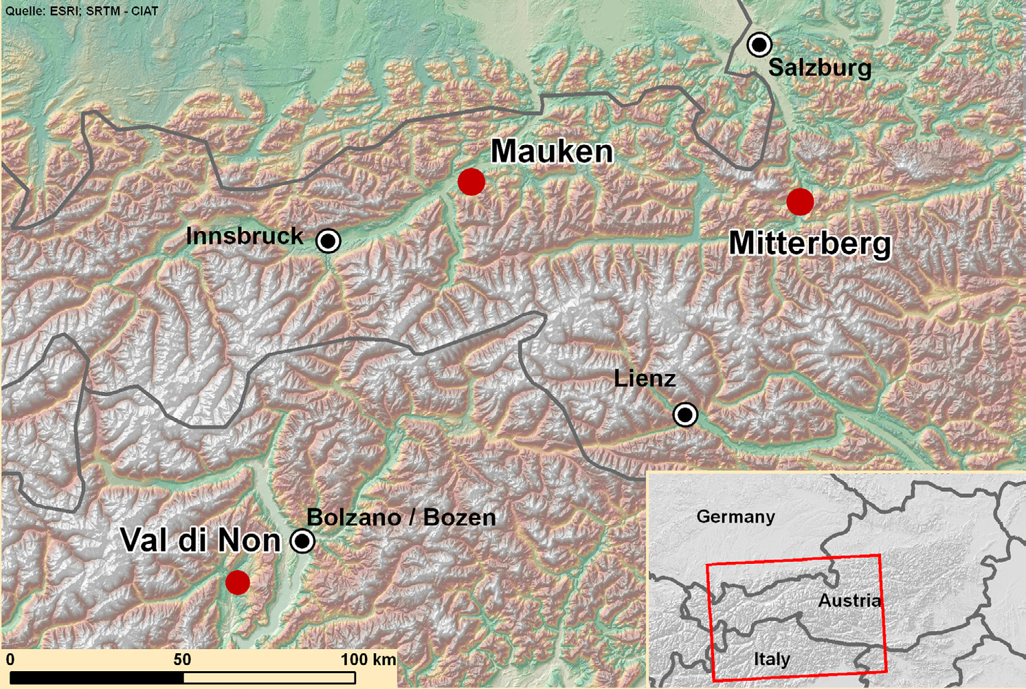
Fig. 1 – The map of the study areas: Mauken, Mitterberg and the Val di Non.
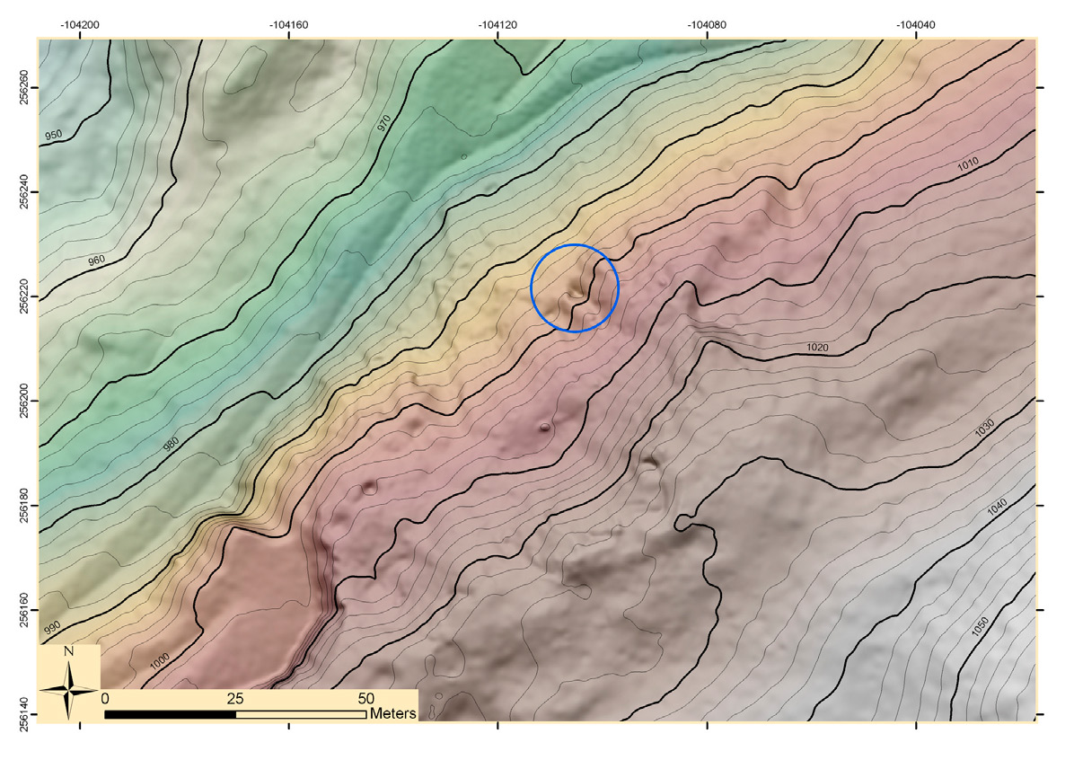
Fig. 2 – High resolution DTM of the Mauken E site: the circle indicates the mini...
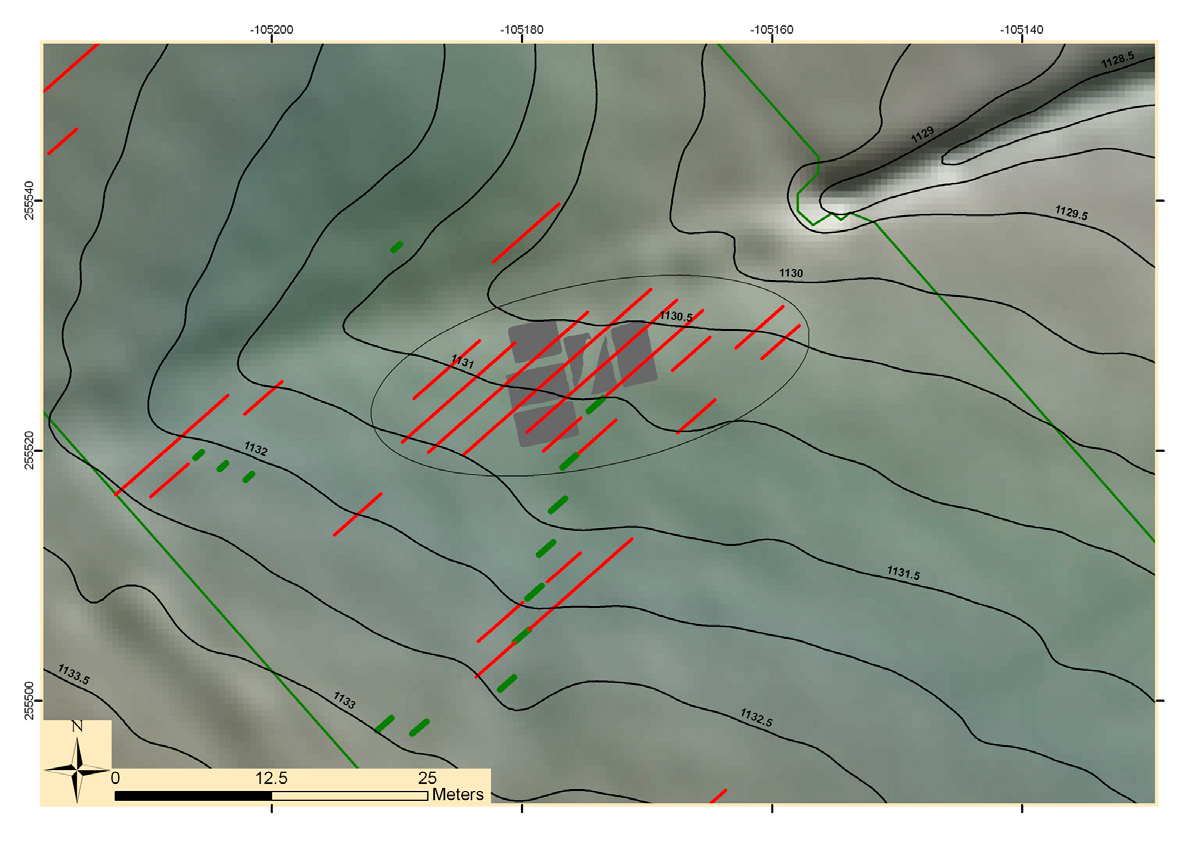
Fig. 3 – GIS based documentation of the Mauken F site: the high resolution 3D di...
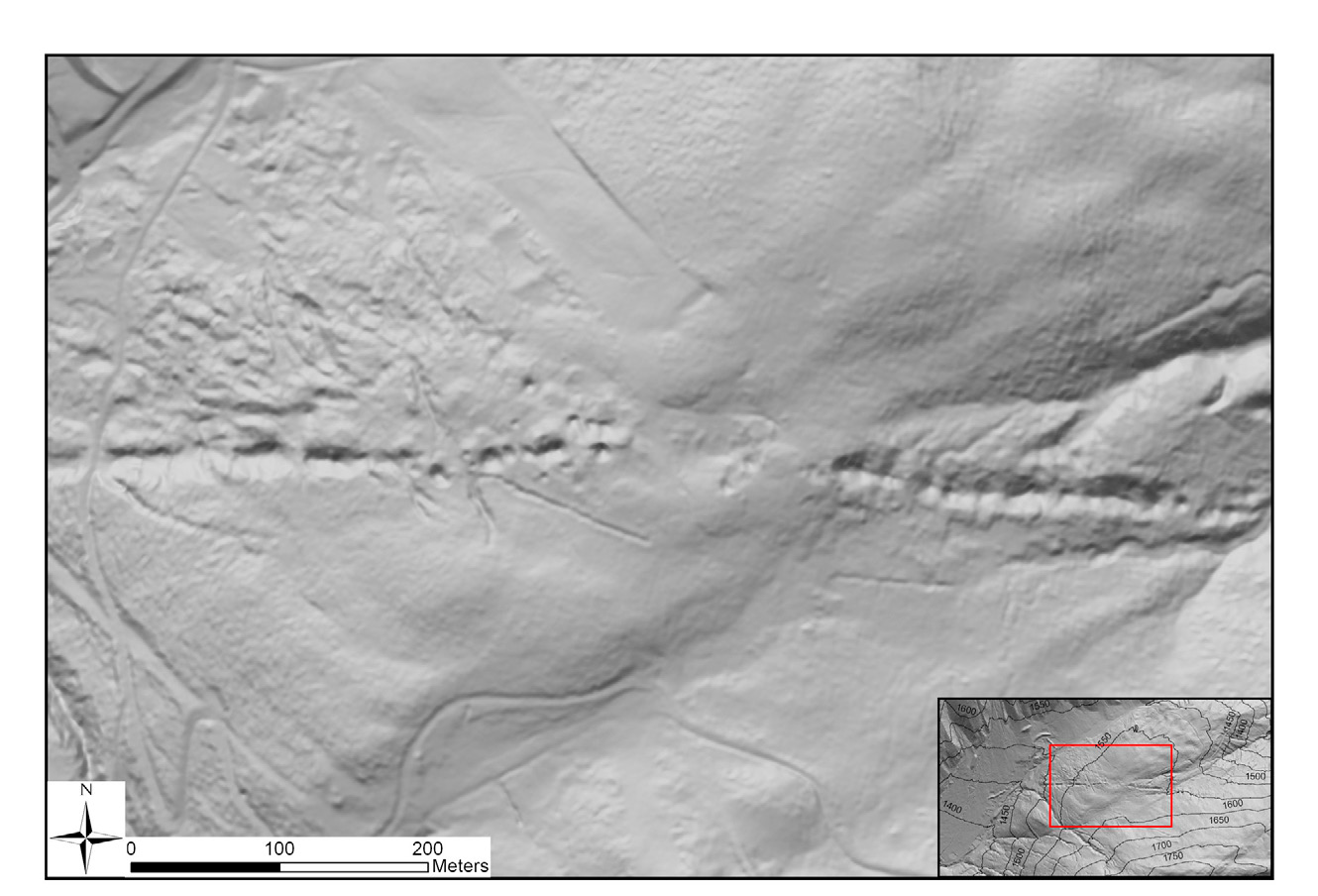
Fig. 4 – Visualisation of the mining extraction impacts in the Mitterberg region...
Fig. 5 – Romeno-Doss Busen: different illumination effects in LiDAR derived mode...
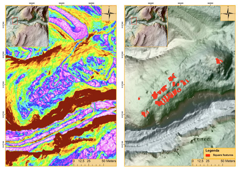
Fig. 6 – Romeno-Doss Busen: slope model and the map of the main archaeological f...
Fig. 7 – Vervò-Castelaz: slope model and the map of the main archaeological feat...
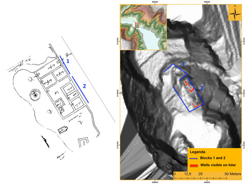
Fig. 8 – Cagnò Castle: map of Jörg Kölderer and map of the main archaeological f...
Kovacs K., Hanke K., Lenzi K., Possenti E., Brogiolo G. 2012, Utilization of airborne LiDAR datasets in GIS environment for prospection of archaeological sites in high Alpine regions, Archeologia e Calcolatori 23