IADI Image
Metadata
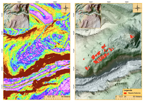
| Caption | Romeno-Doss Busen: slope model and the map of the main archaeological features. |
| Figure number | 6 |
| Article | Utilization of airborne LiDAR datasets in GIS environment for prospection of archaeological sites in high Alpine regions |
| Authors | Kovacs K., Hanke K., Lenzi K., Possenti E., Brogiolo G. |
| Volume | Volume 23 |