Volumes / Journal / 21 - 2010 / Masini N., Coluzzi R., Lasaponara R.
Click on any image to open slideshow
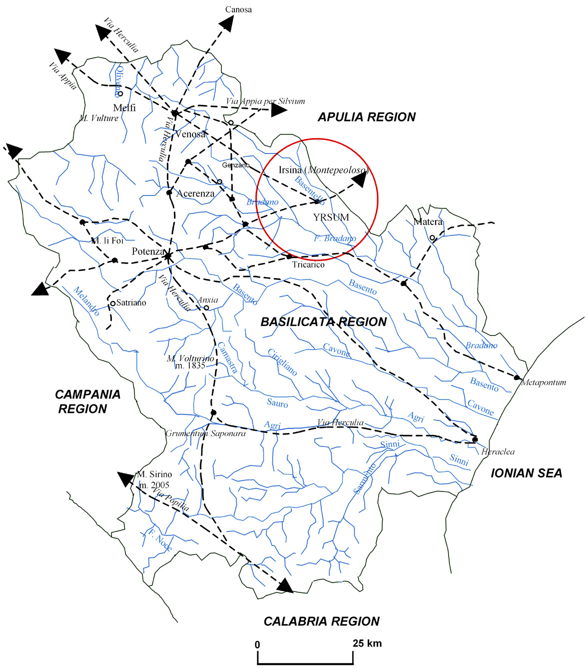
Fig. 1 – Study area location.
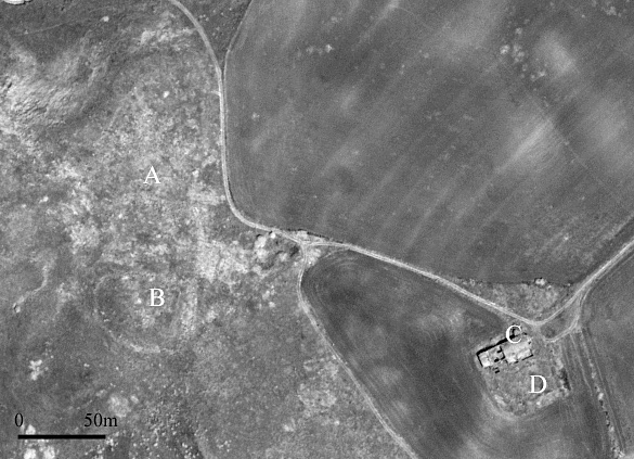
Fig. 2 – QuickBird panchromatic image of Monte Irsi. A and B indicate the invest...
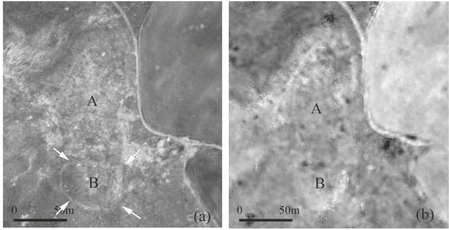
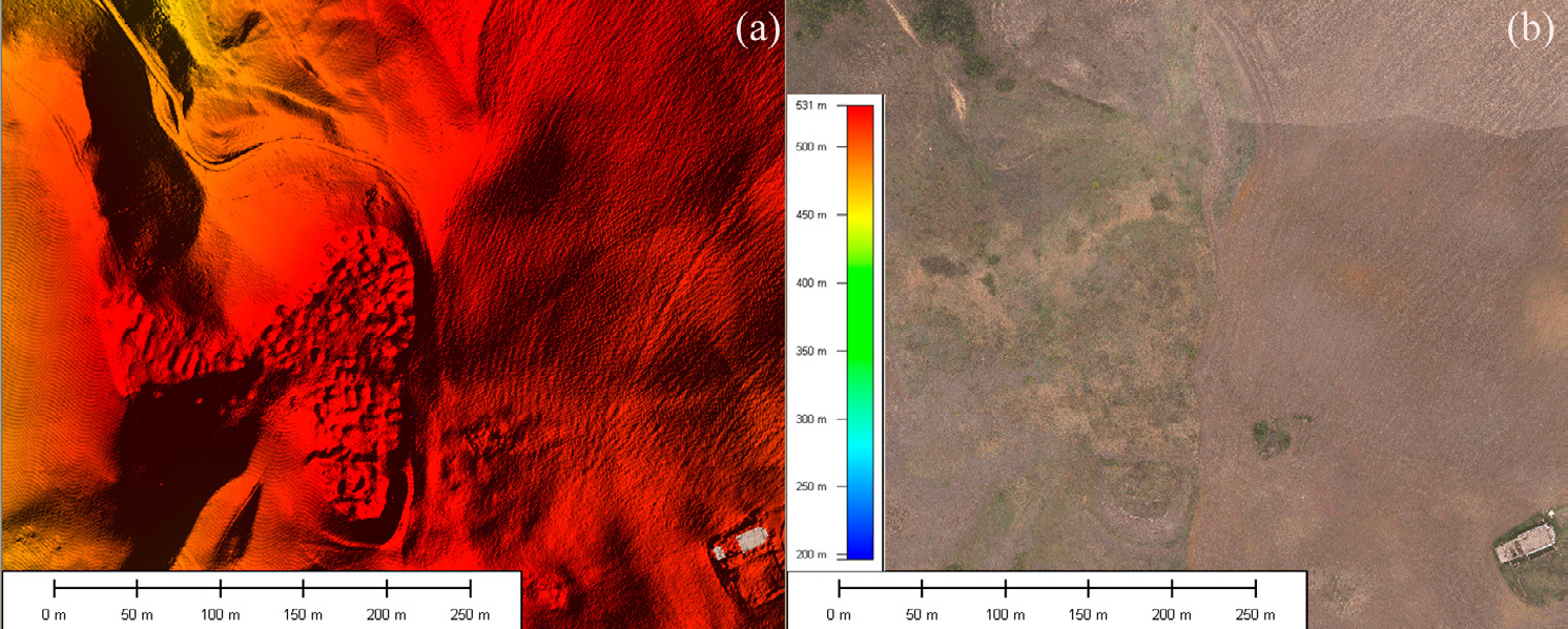
Fig. 3 – Investigated area. (a) QuickBird panchromatic image; (b) Red pansharpen...
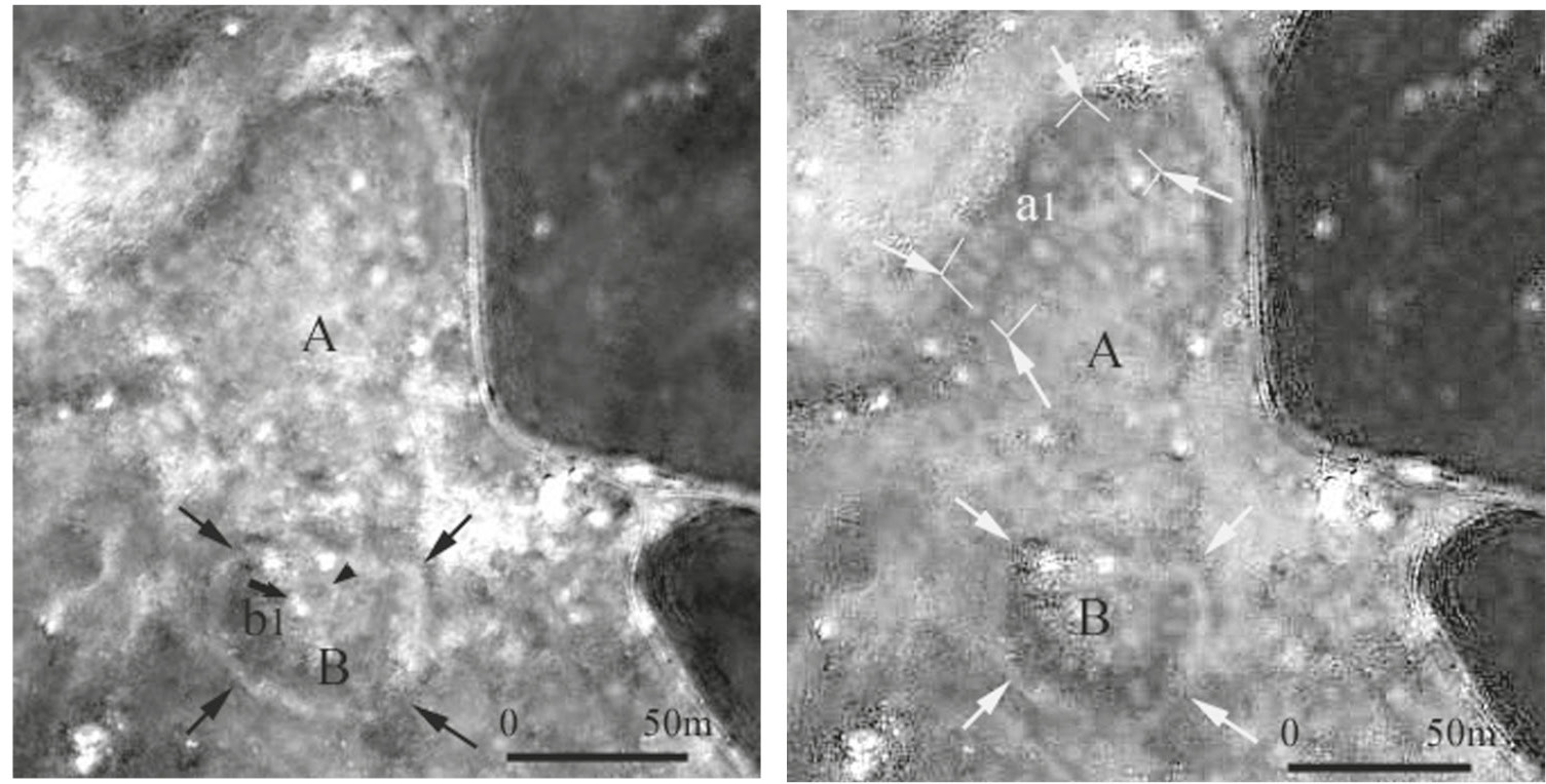
Fig. 4 – NIR pansharpened band. A ditched enclosure (B) and traces of surface wa...
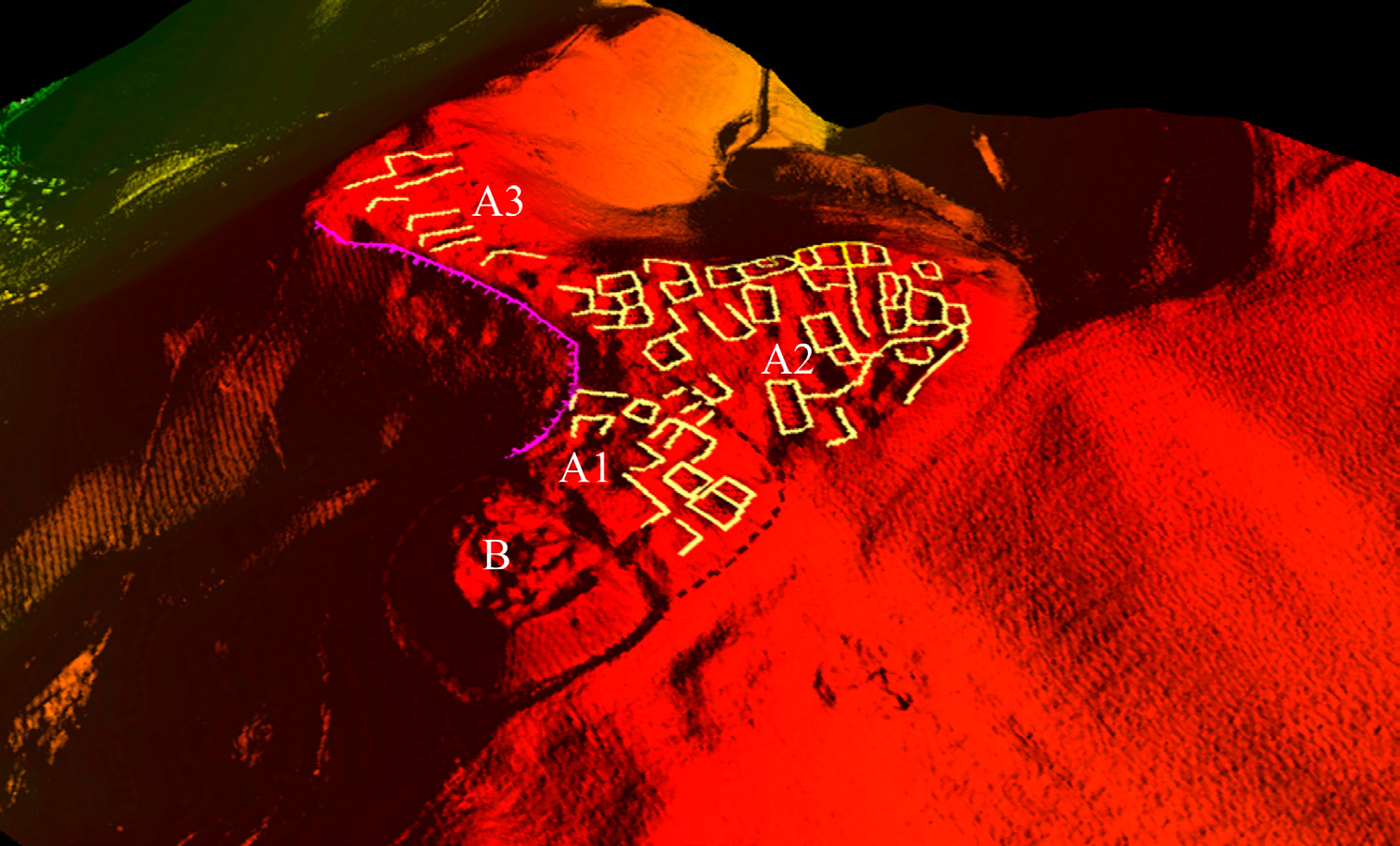
Fig. 6 – 3D view of DTM: a) DTM of the medieval settlements and surroundings, b)...
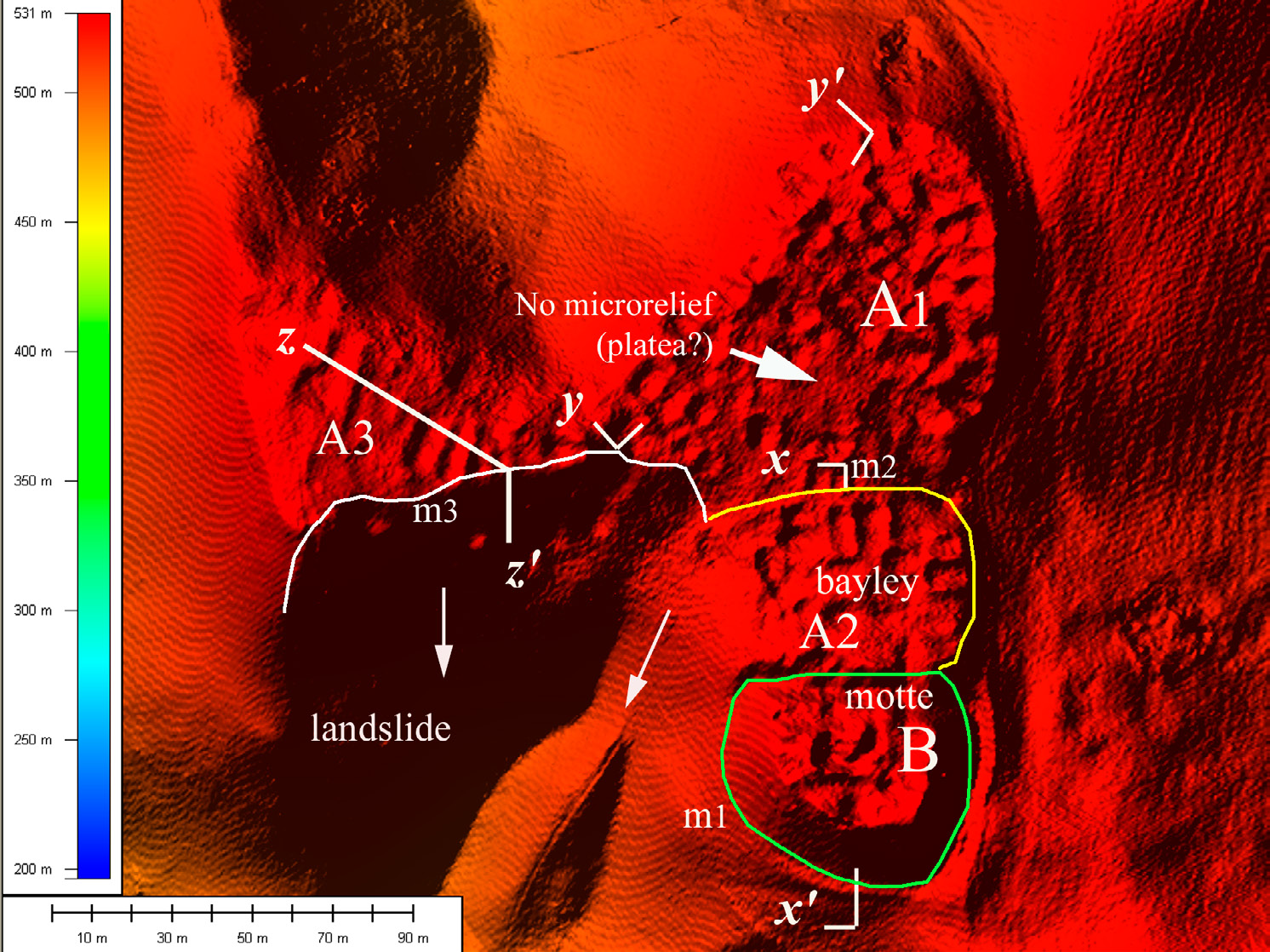
Fig. 7 – Interpretation of DTM for the medieval settlements.
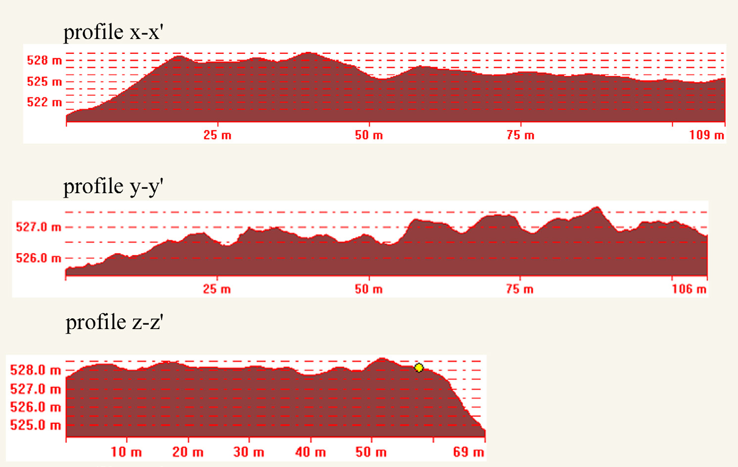
Fig. 8 – Altitude profiles for area indicated in Fig. 7.
Fig. 9 – Detailed reconstruction of the urban fabric.
Masini N., Coluzzi R., Lasaponara R. 2010, Investigating lost medieval villages using Satellite and Airborne Laser Scanning: the case of Yrsum in Basilicata (Southern Italy), Archeologia e Calcolatori 21