IADI Image
Metadata
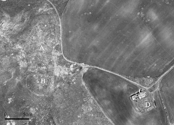
| Caption | QuickBird panchromatic image of Monte Irsi. A and B indicate the investigated settlement and the artificial mound related to the documented castle (Castrum Ursum), respectively; C and D denote the church of S. Maria d’Irsi and the Roman villa, respectively. |
| Figure number | 2 |
| Article | Investigating lost medieval villages using Satellite and Airborne Laser Scanning: the case of Yrsum in Basilicata (Southern Italy) |
| Authors | Masini N., Coluzzi R., Lasaponara R. |
| Volume | Volume 21 |