Volumes / Journal / 16 - 2005 / Kay S., Witcher R.
Click on any image to open slideshow
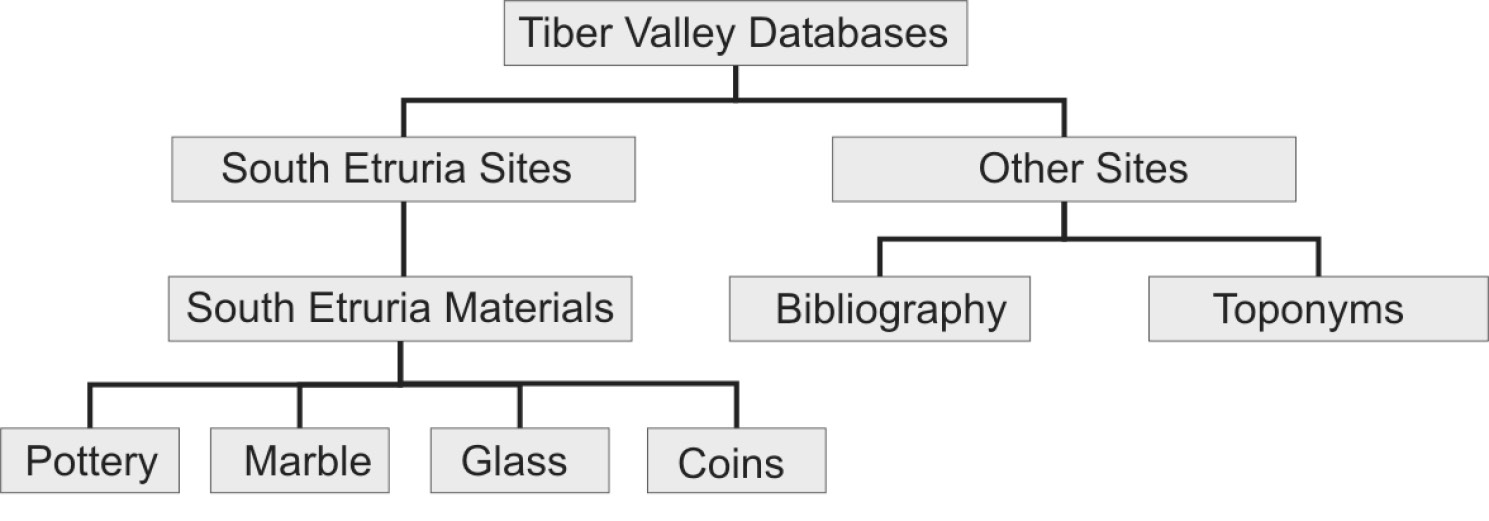
Fig. 1 – Structure of the Tiber Valley Project databases.
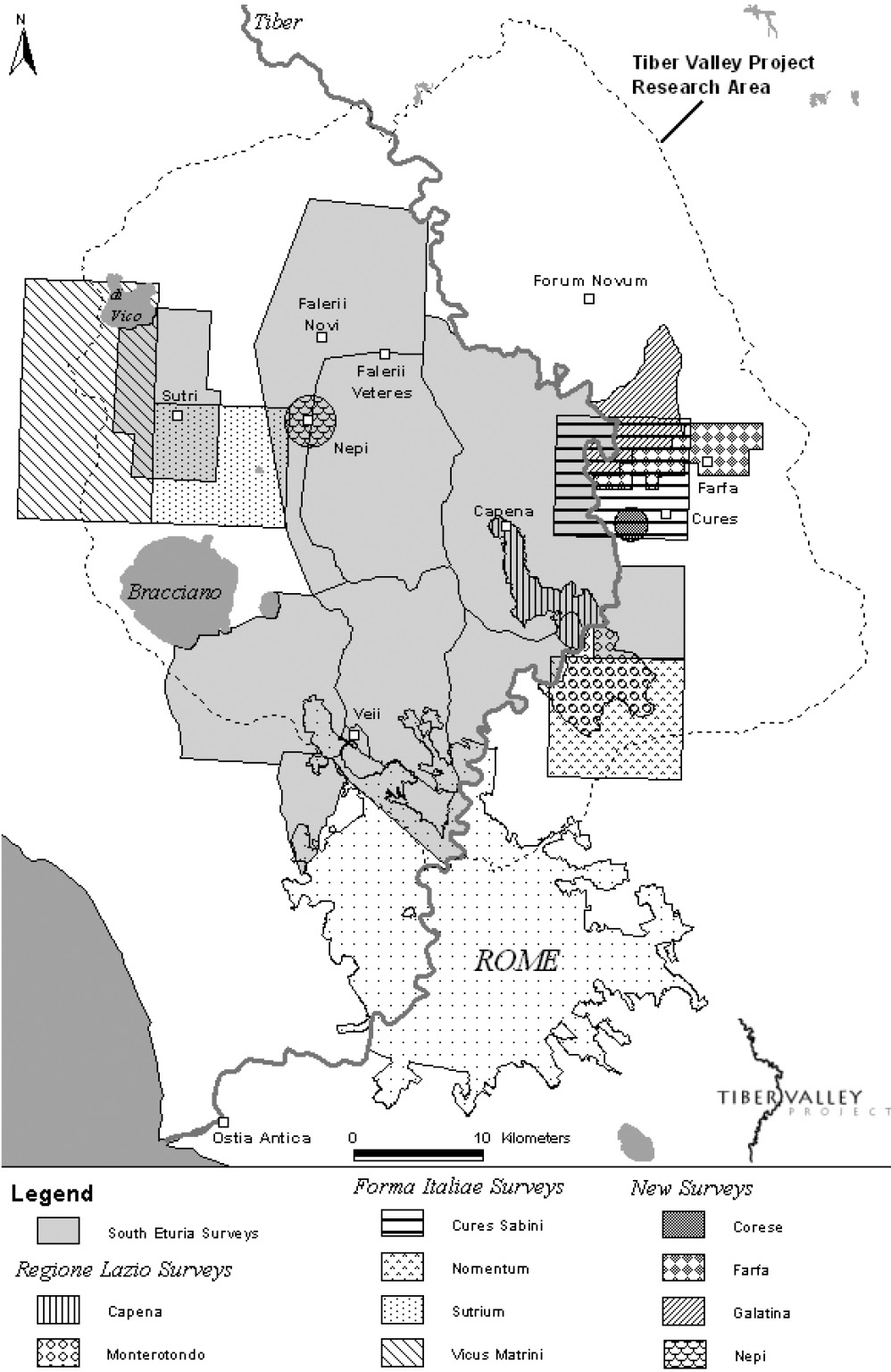
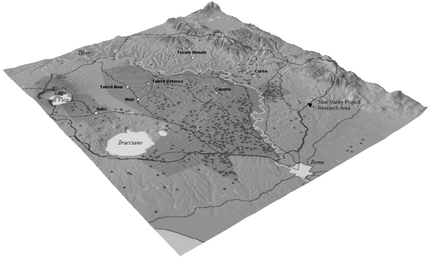
Fig. 2 – Tiber Valley Project research area, showing the surveys and other place...
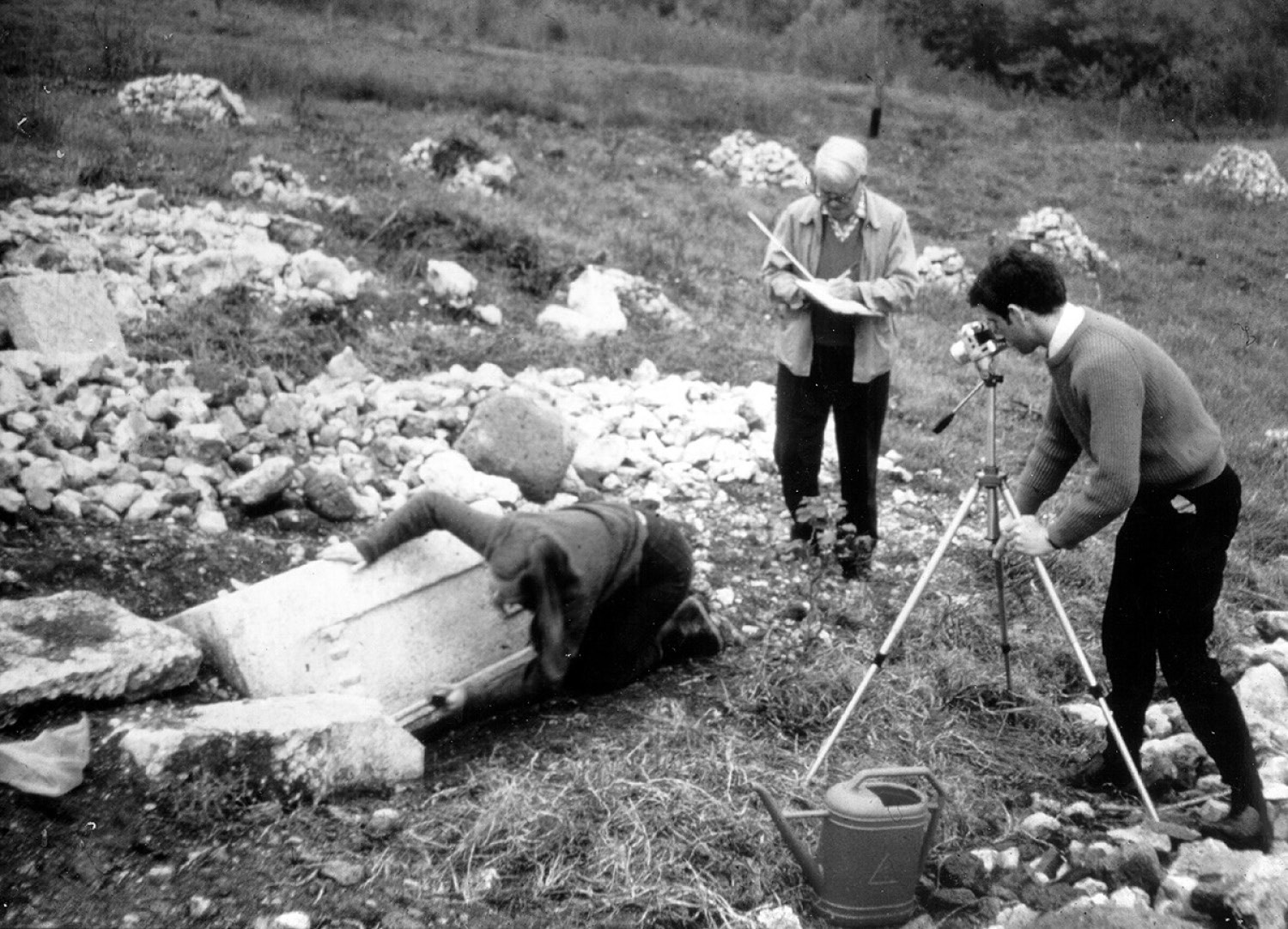
Fig. 3 – John Ward-Perkins in the field during the South Etruria Survey recordin...
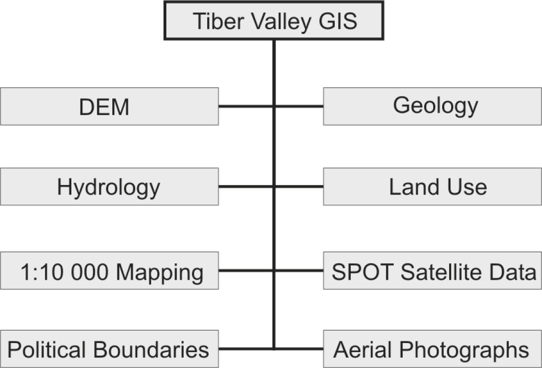
Fig. 4 – Geographical and environmental datasets used within the Tiber Valley Pr...
Fig. 5 – DEM illustrating the locations of Early Imperial villas within the Tibe...
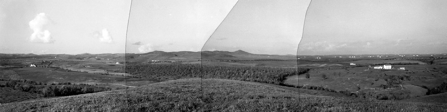
Fig. 6 – Panorama (photographed and mounted by Ward-Perkins, 1960) looking north...
Kay S., Witcher R. 2005, The Tiber Valley Project. The role of GIS and databases in field survey data integration and analysis, Archeologia e Calcolatori 16