Volumes / Journal / 15 - 2004 / Burillo Mozota F., Escolano Utrilla S., Ruíz Budría E.
Click on any image to open slideshow
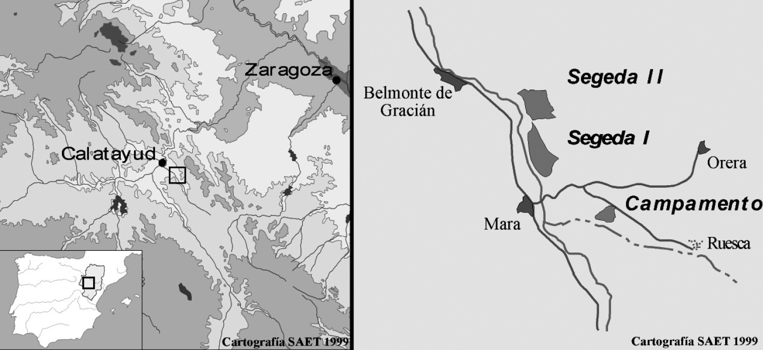
Fig. 1 – Location of Segeda.
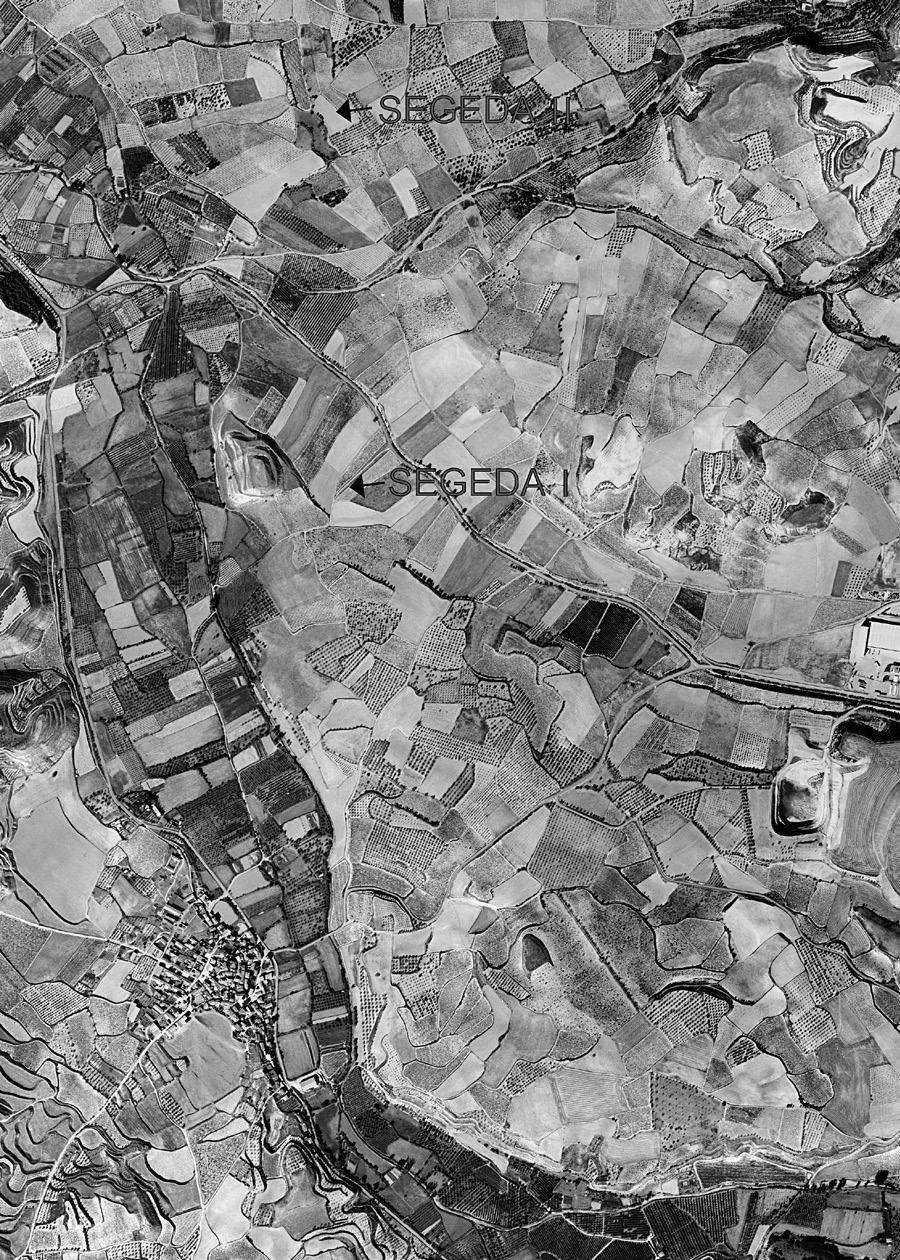
Fig. 2 – Limits of Segeda I and Segeda II, aerial view.
Fig. 3 – Cities and ethnic groups that participated in the Celtiberian Wars of 1...
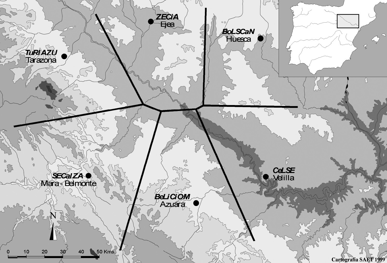
Fig. 4 – Cities that minted denarii in the middle Valley of Ebro and hierarchy o...
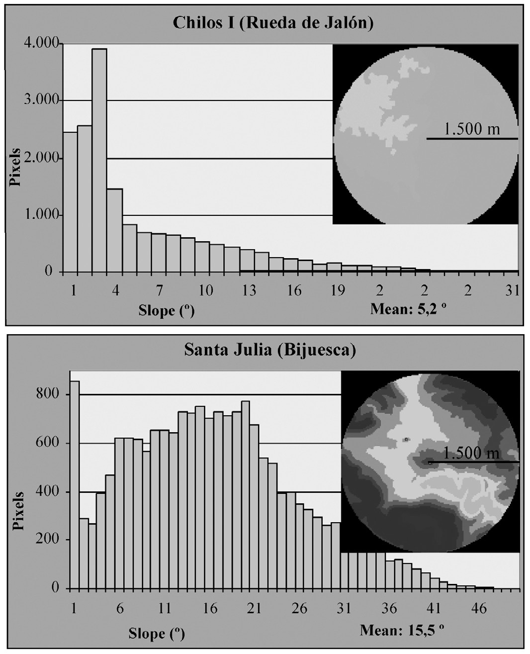
Fig. 5 – Distribution of slopes on the sites’ surroundings.
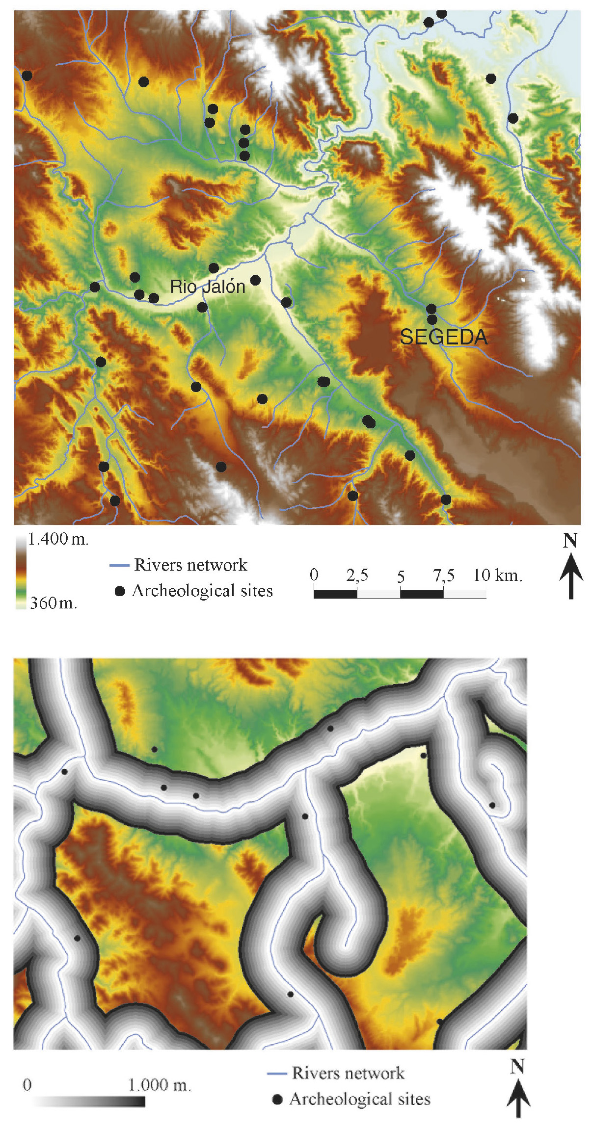
Tav. VIII – a: Digital Elevation Model of Segeda and its environs. b: Distance f...
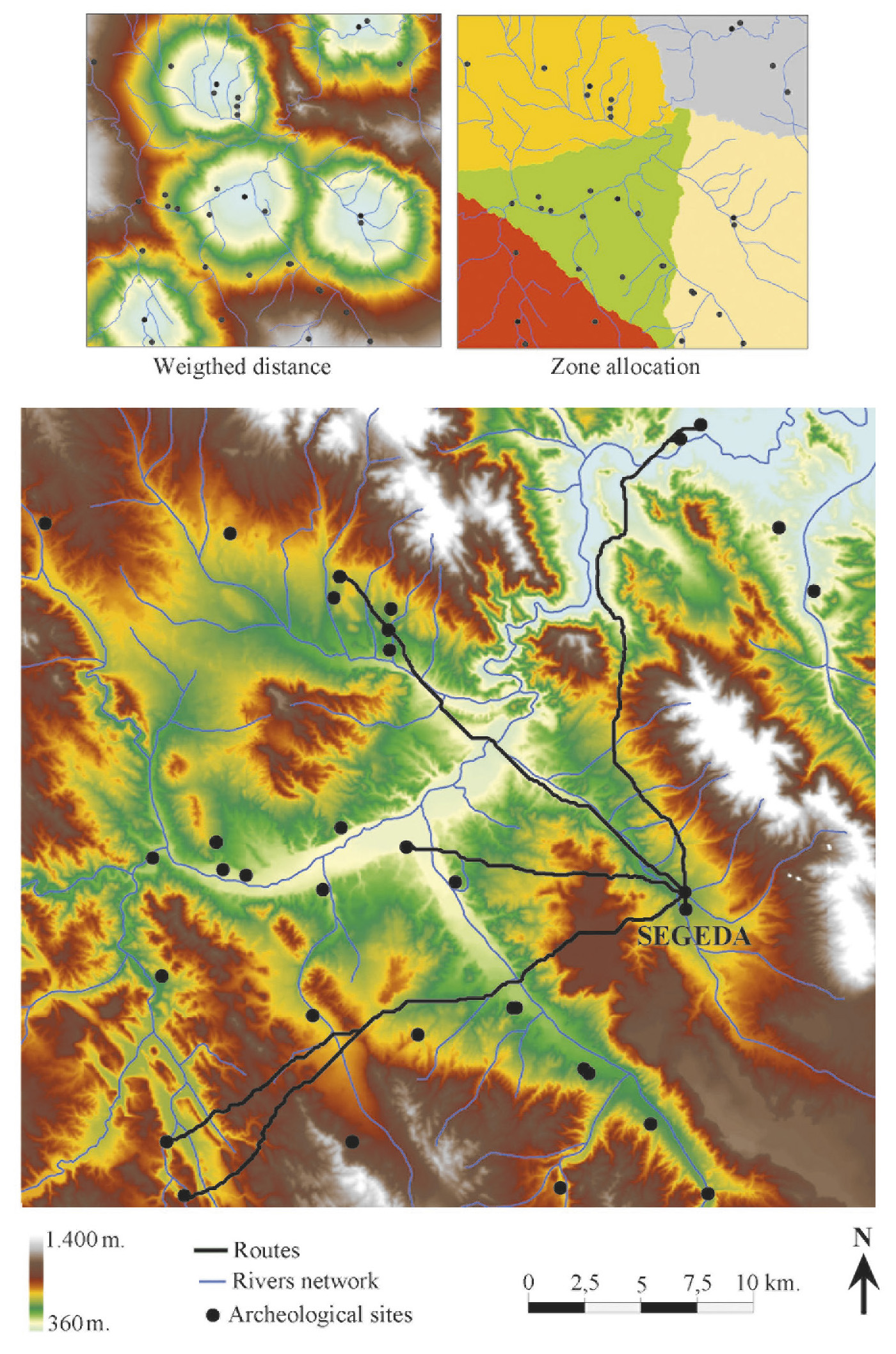
Tav. IX – a: Allocation of zones between the neighbouring sites according to the...
Burillo Mozota F., Escolano Utrilla S., Ruíz Budría E. 2004, 'Segeda Project': the I.T. management of the territory of a Celtiberian city-state, Archeologia e Calcolatori 15