IADI Image
Metadata
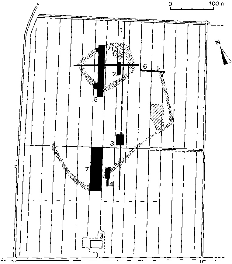
| Caption | Map of the S. Rosa terramara. Dotted areas indicate ramparts as they appear in aerial photographs; in grey, area excavated up to now. |
| Figure number | 2 |
| Article | Reconstructing a fossil landscape by Remote Sensing and GIS applications: sites, virtual models and territory during the Middle Bronze Age in the Po Plain (Northern Italy) |
| Authors | Cremaschi M., Forte M. |
| Volume | Volume 10 |