Volumes / Journal / 5 - 1994 / Gaffney V., Stancic Z.
Click on any image to open slideshow
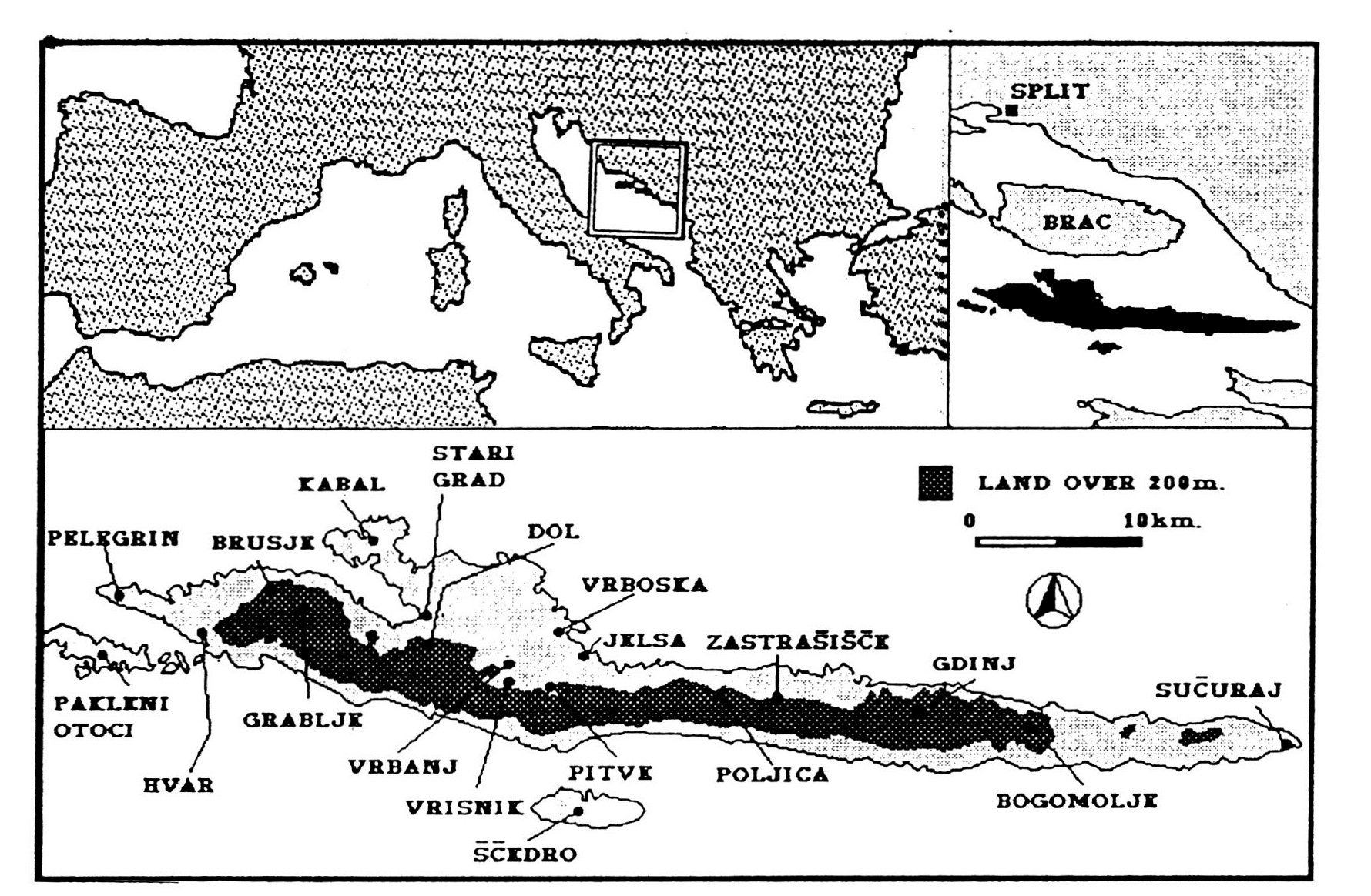
Fig. 1 - Location map of the lsland of Hvar.
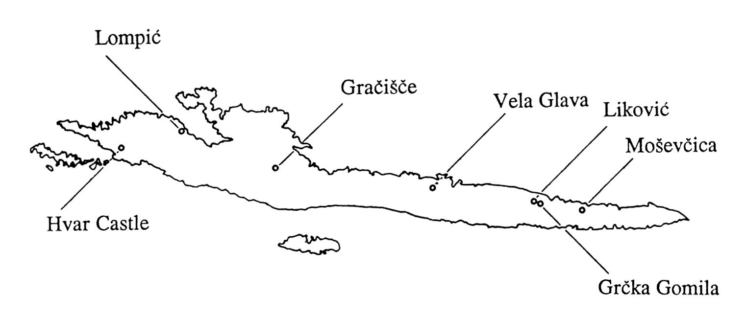
Fig. 2 - Principle Iron Age hillforts.
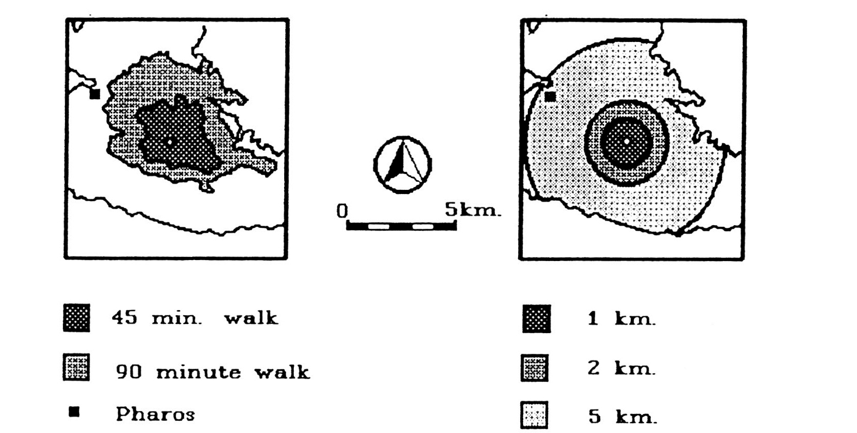
Fig. 3 - Territory of the Gracisce hillfort derived through the Cost Surface and...
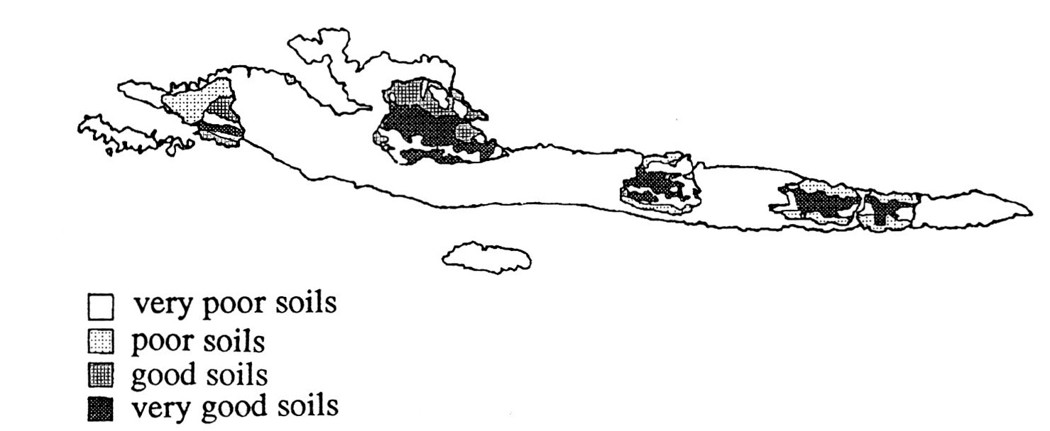
Fig. 4 - Soils within major hillfort territories.
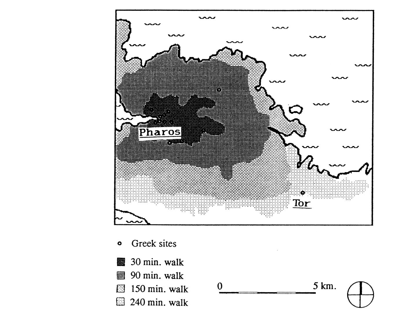
Fig. 5 - A cost surface analysis between Pharos and the tower at Tor.
Gaffney V., Stancic Z. 1994, GIS and historical archaeology. The case of the island of Hvar in Croatia, Archeologia e Calcolatori 5