Volumes / Journal / 26 - 2015 / Mantellini S.
Click on any image to open slideshow
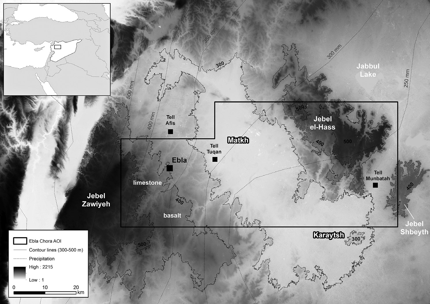
Fig. 1 – The site of Tell Mardikh-Ebla and the main ecological features of the a...
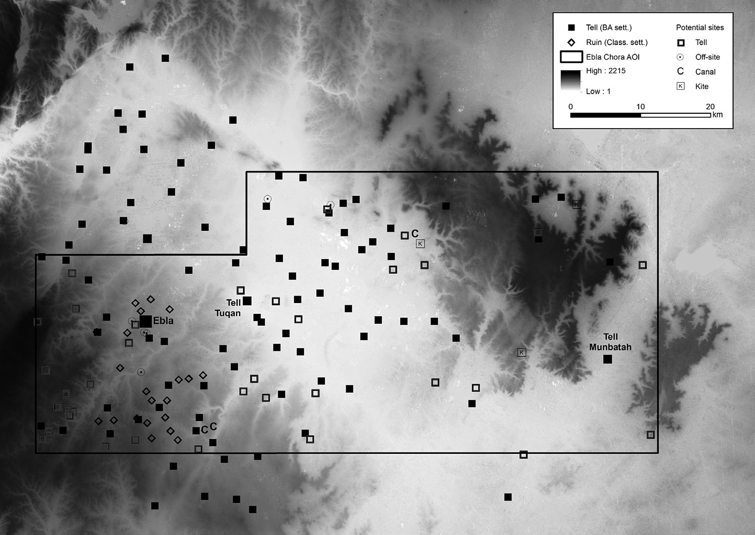
Fig. 2 – Archaeological assessment in the Eblaite chora, including the ruins of ...
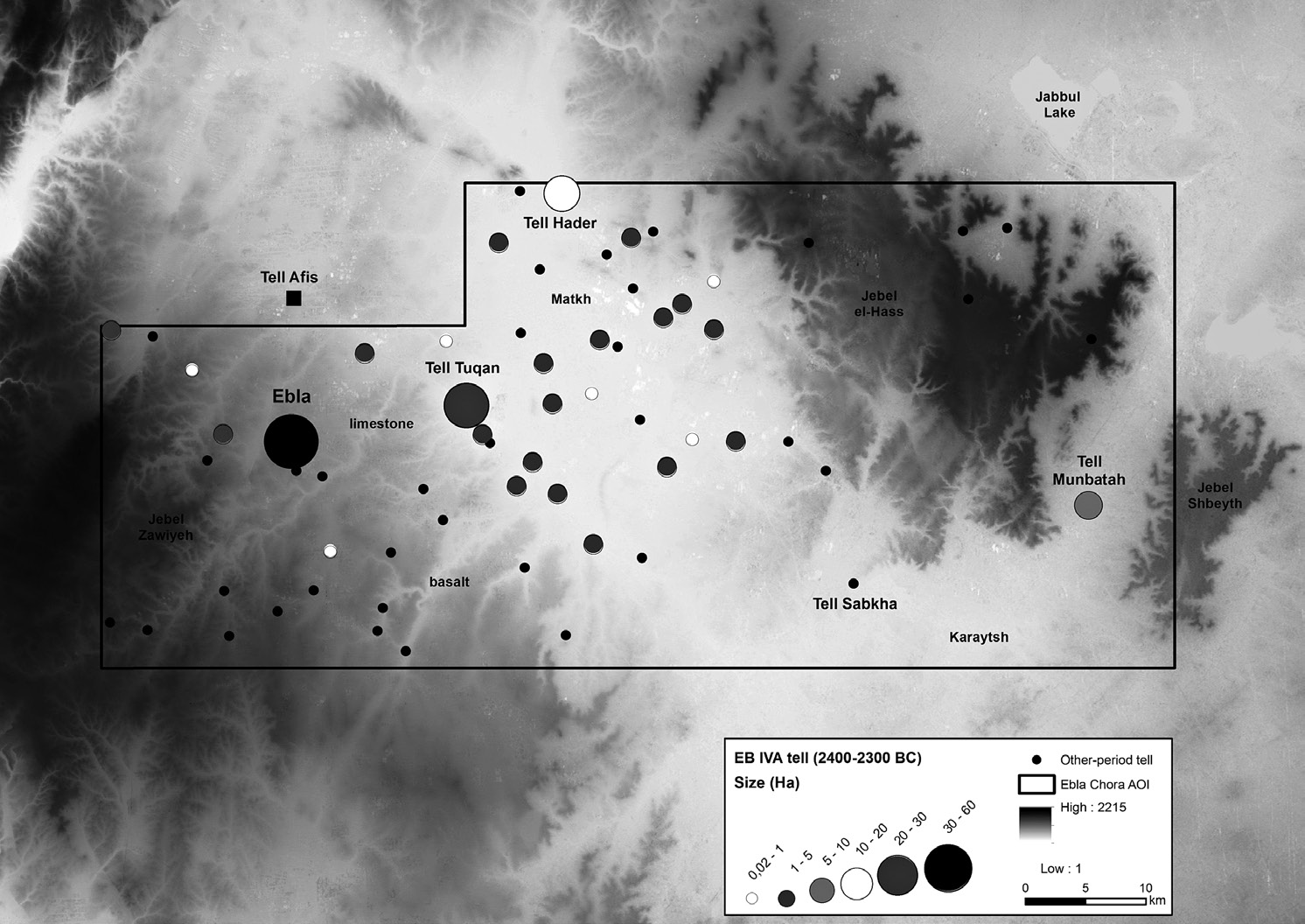
Fig. 3 – Classification of the EB IVA sites (2400-2300 BC) according to the size...
Mantellini S. 2015, GIS and remote sensing for a preliminary assessment of the archaeological landscape in the Eblaite chora (Syria), Archeologia e Calcolatori 26