Volumes / Journal / 24 - 2013 / Colosi F. et al.
Click on any image to open slideshow
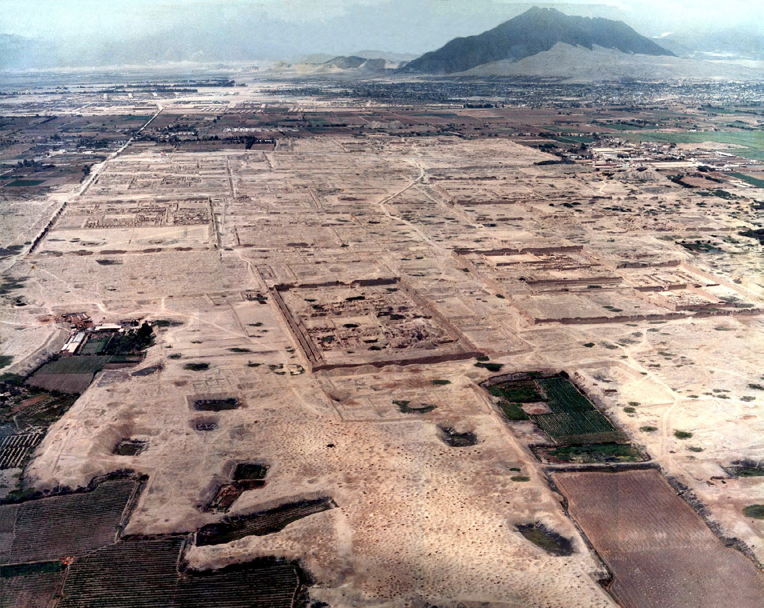
Fig. 1 – Chan Chan. An aerial view of the monumental site (photo Consorcio Chimú...
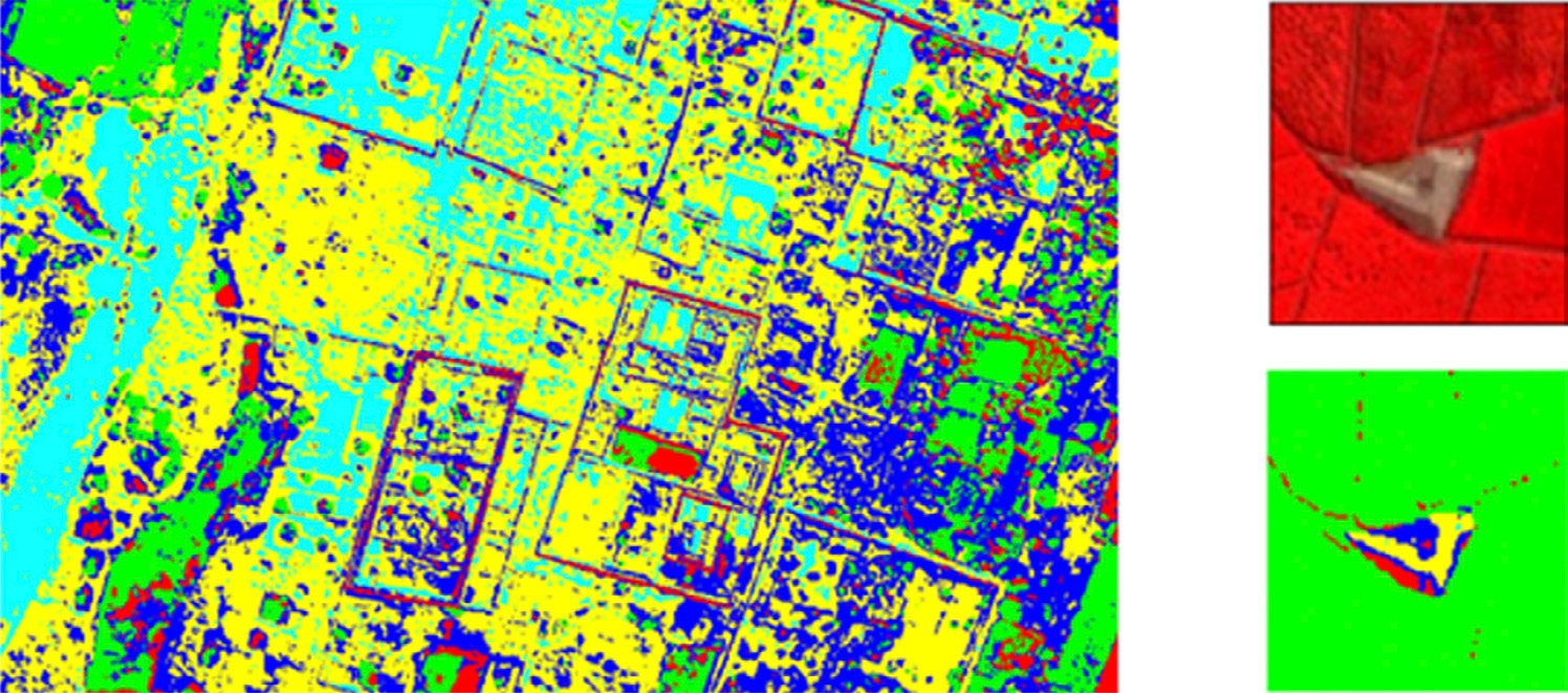
Fig. 2 – The fuzzy unsupervised classification evidences the archaeological stru...
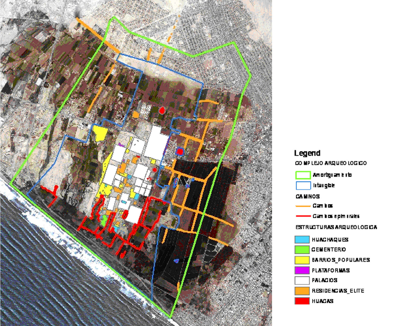
Fig. 3 – GIS of Chan Chan.
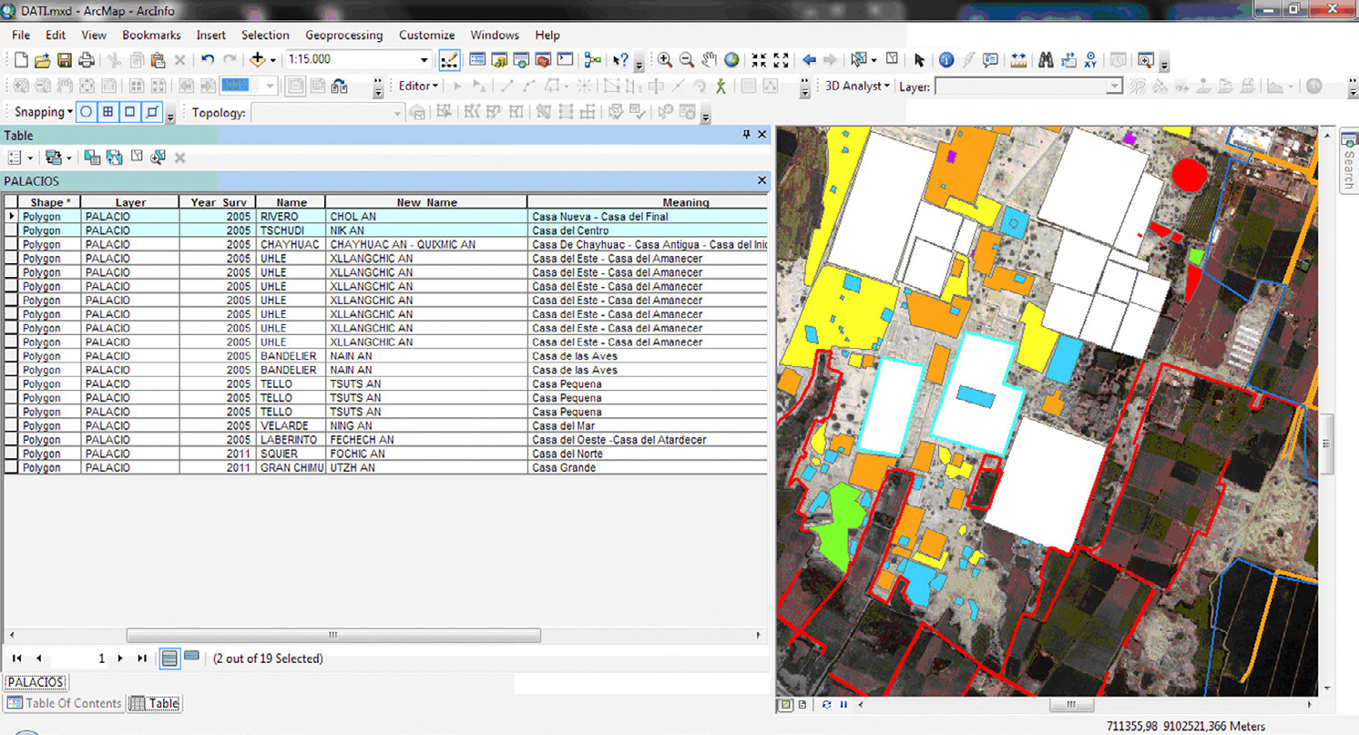
Fig. 4 – Spatial selection of two “Palacios”: Rivero and Tschudi and their attri...
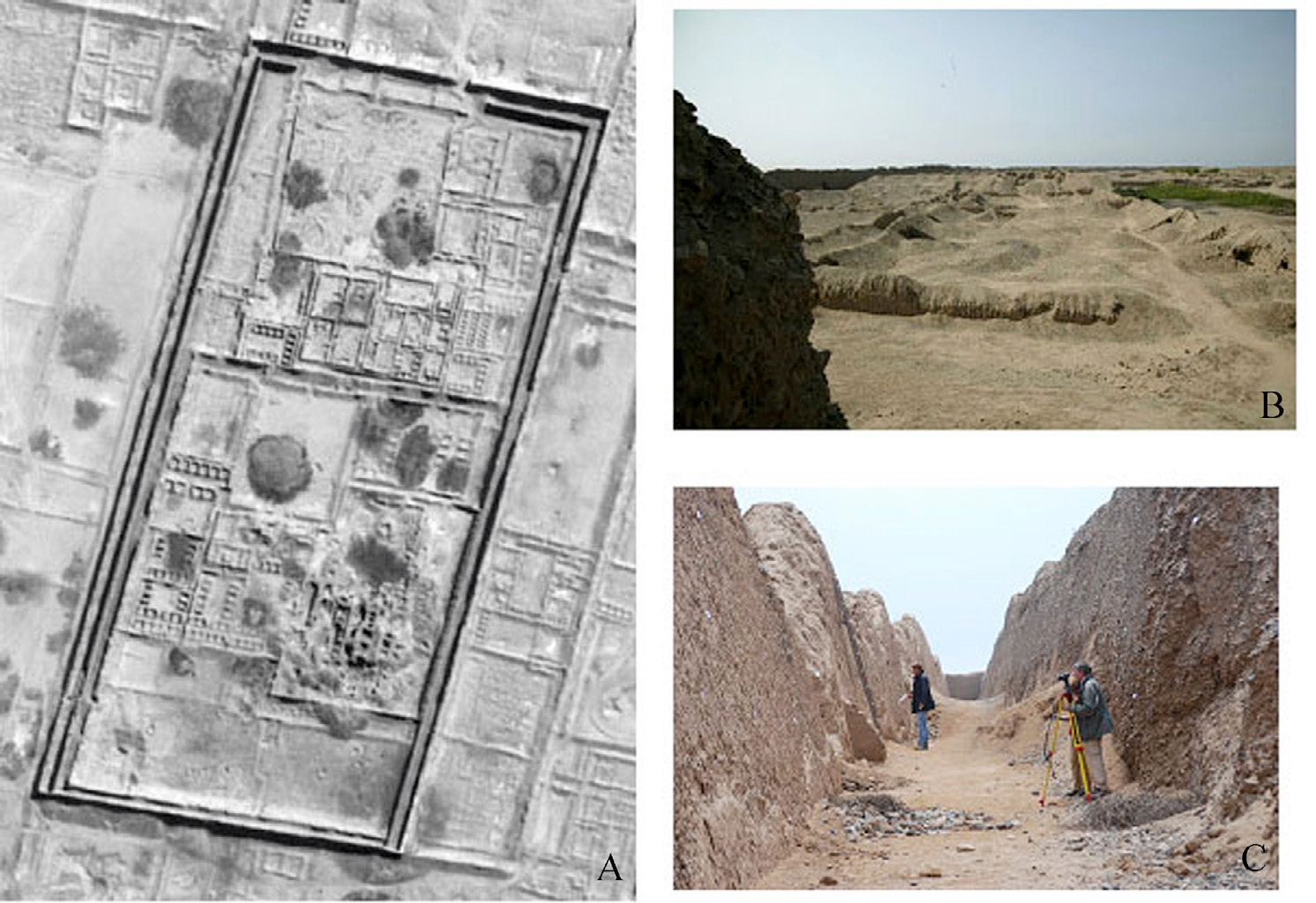
Fig. 5 – Palacio Rivero. A) Aerial view of the palace (Quickbird image 2003); B)...
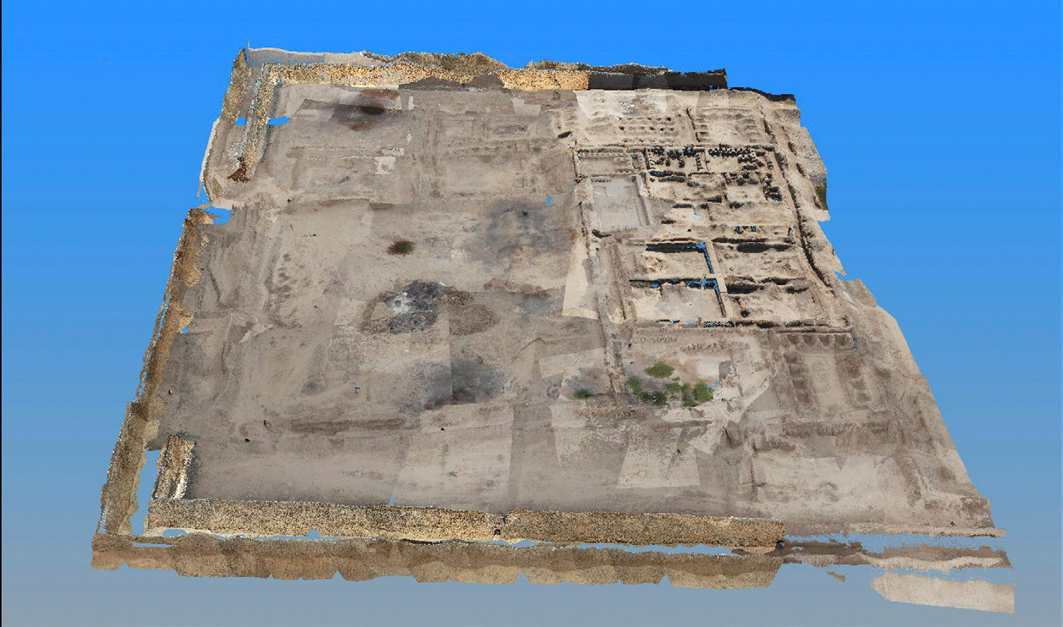
Fig. 6 – 3D photogrammetric survey of the first sector of Palacio Rivero (Colosi...
Fig. 7 – 3D laser scanner survey of Palacio Rivero. A) First processing of the P...
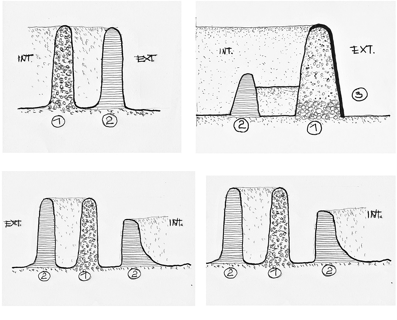
Fig. 8 – Schematic sections of the perimetral walls of Ciudadela Rivero (n. 1 ta...
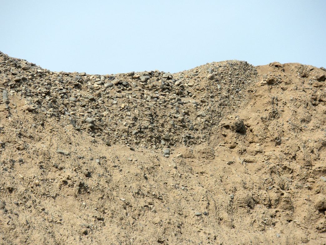
Fig. 9 – The outside of the southern wall of Ciudadela Rivero: the original stru...
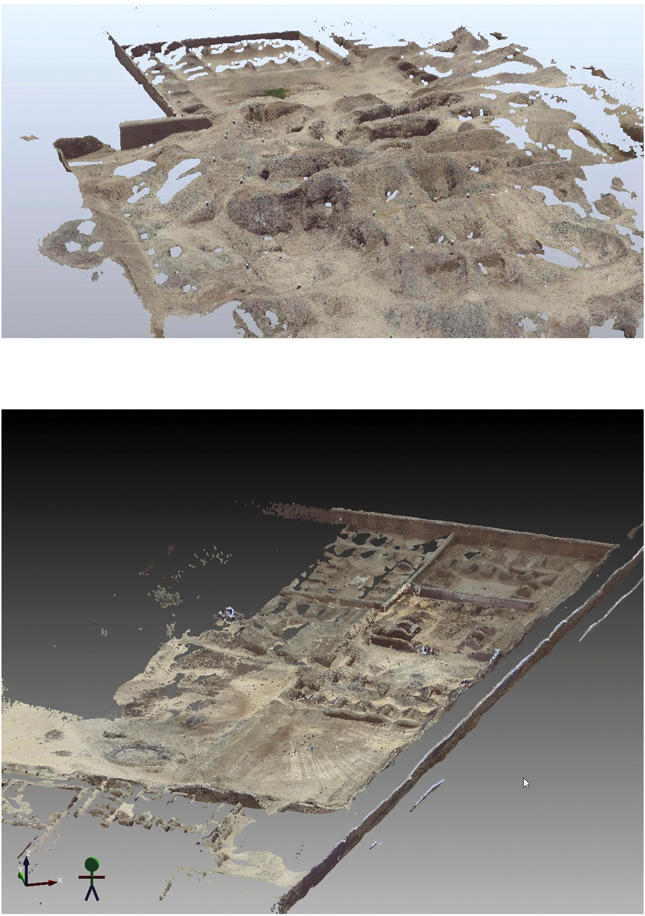
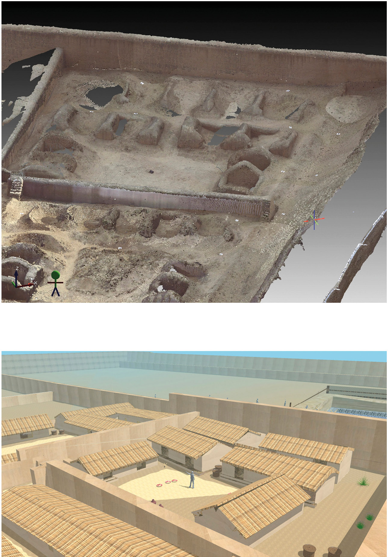
Fig. 10 – Ciudadela Rivero: warehouses in the central sector. A) Laser scanner s...
Colosi F., Gabrielli R., Orazi R., Malinverni E. 2013, Discovering Chan Chan: modern technologies for urban and architectural analysis, Archeologia e Calcolatori 24