Volumes / Journal / 21 - 2010 / Barbanente A. et al.
Click on any image to open slideshow
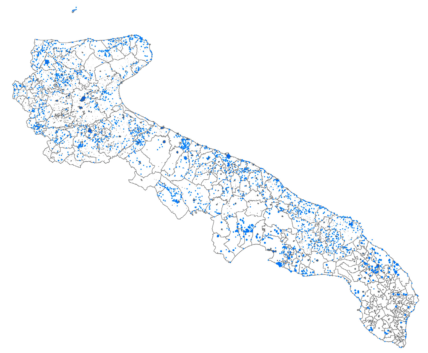
Fig. 1 – The Apulian Cultural Heritage localized by the Project.
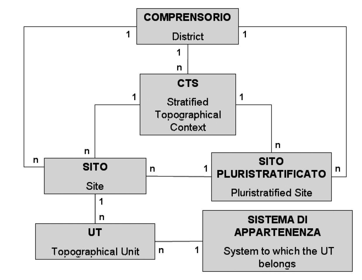
Fig. 2 – Logical structure of the corpus of data.
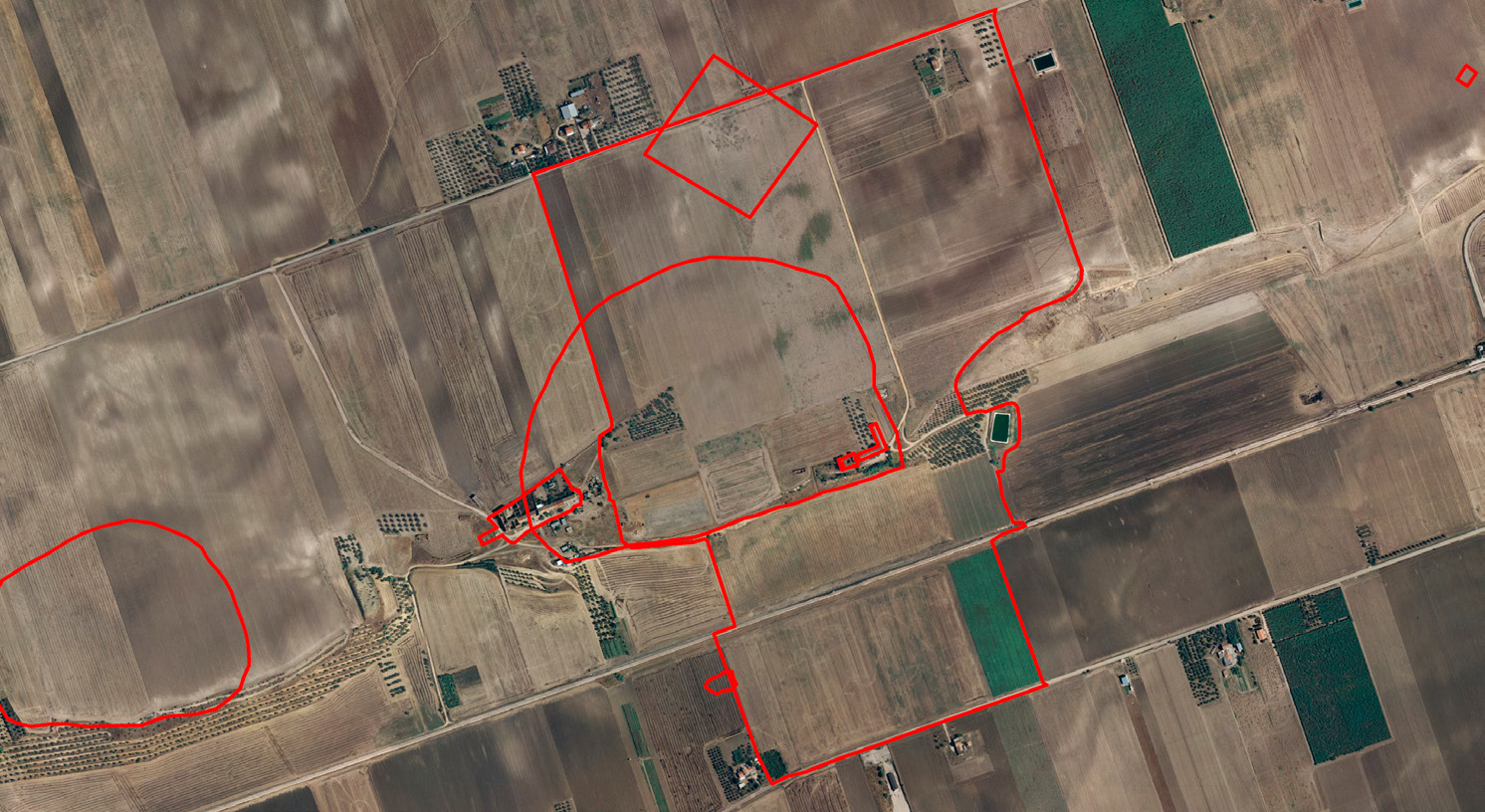
Fig. 3 – Example of a Pluristratified Site in Ponte Albanito (Fg, Apulia): Neoli...
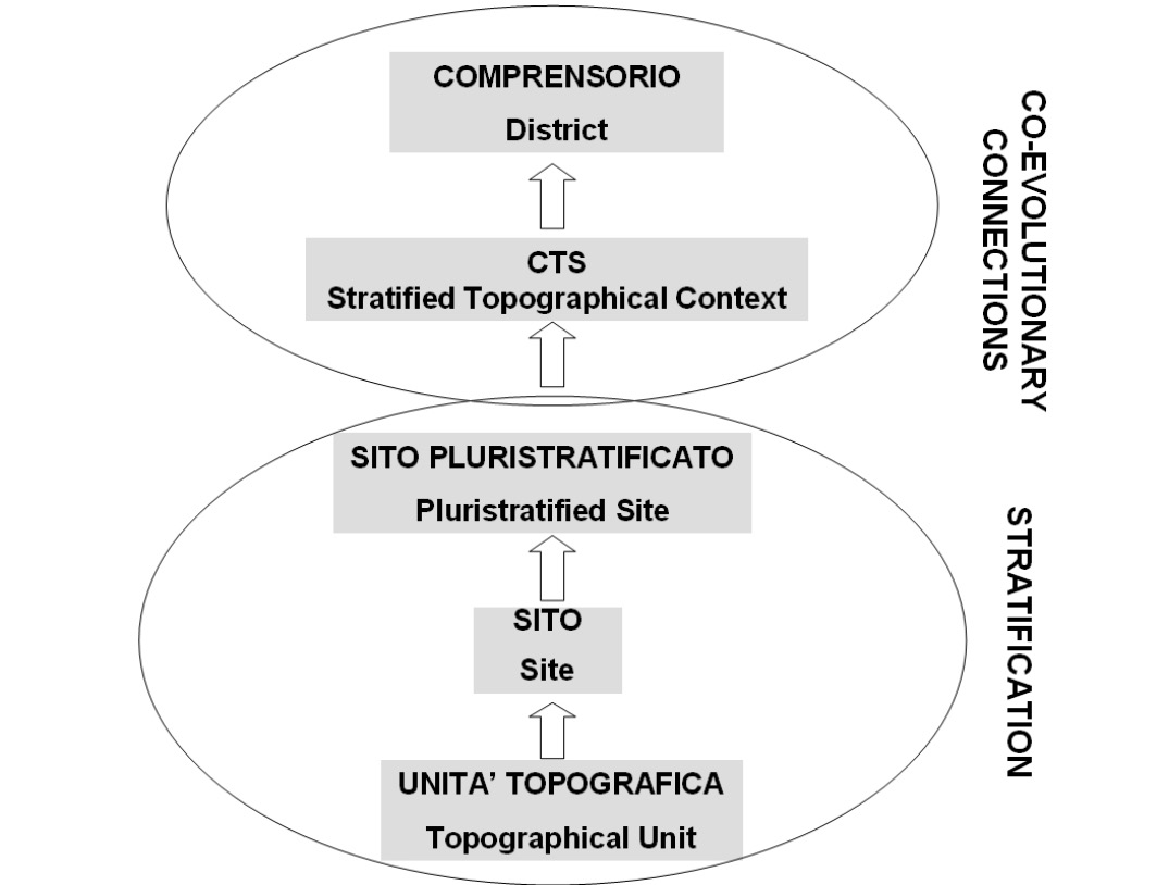
Fig. 4 – The conceptual scheme of the Cultural Heritage Map.
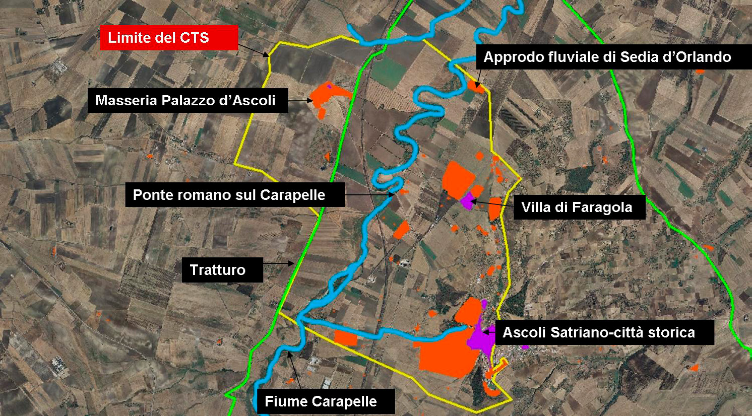
Fig. 5 – The Stratified Topographical Context in Carapelle River Valley.
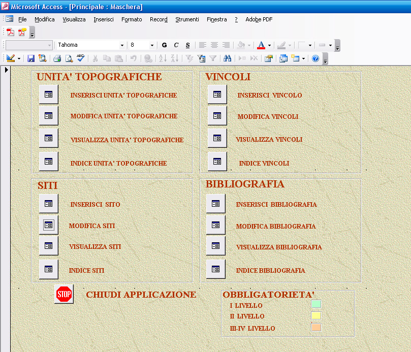
Fig. 6 – The entry form of the DBMS.
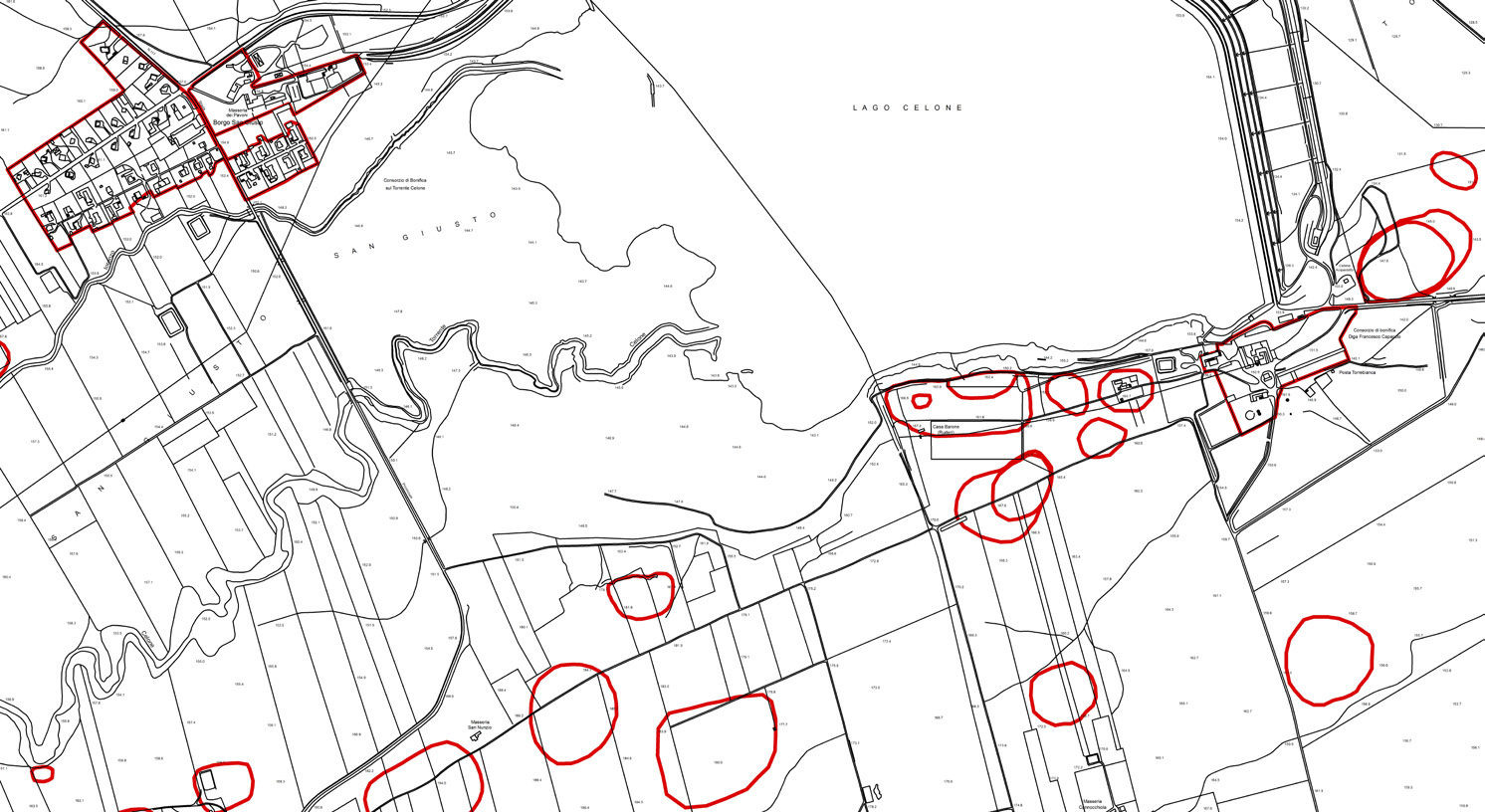
Fig. 7 – Example of localization of SITI and UT on the basis of the new Regional...
Barbanente A., Volpe G., Annese C., Buglione A., Di Zanni A., Goffredo R., Romano A. 2010, The Cultural Heritage Map of Apulia Project, Archeologia e Calcolatori 21