Volumes / Journal / 21 - 2010 / Ştefan D., Sîrbu V.
Click on any image to open slideshow
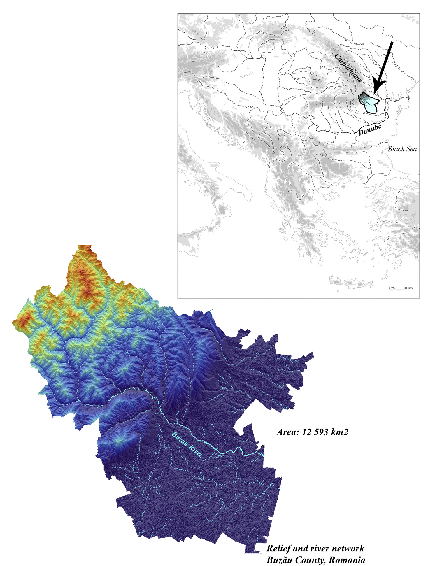
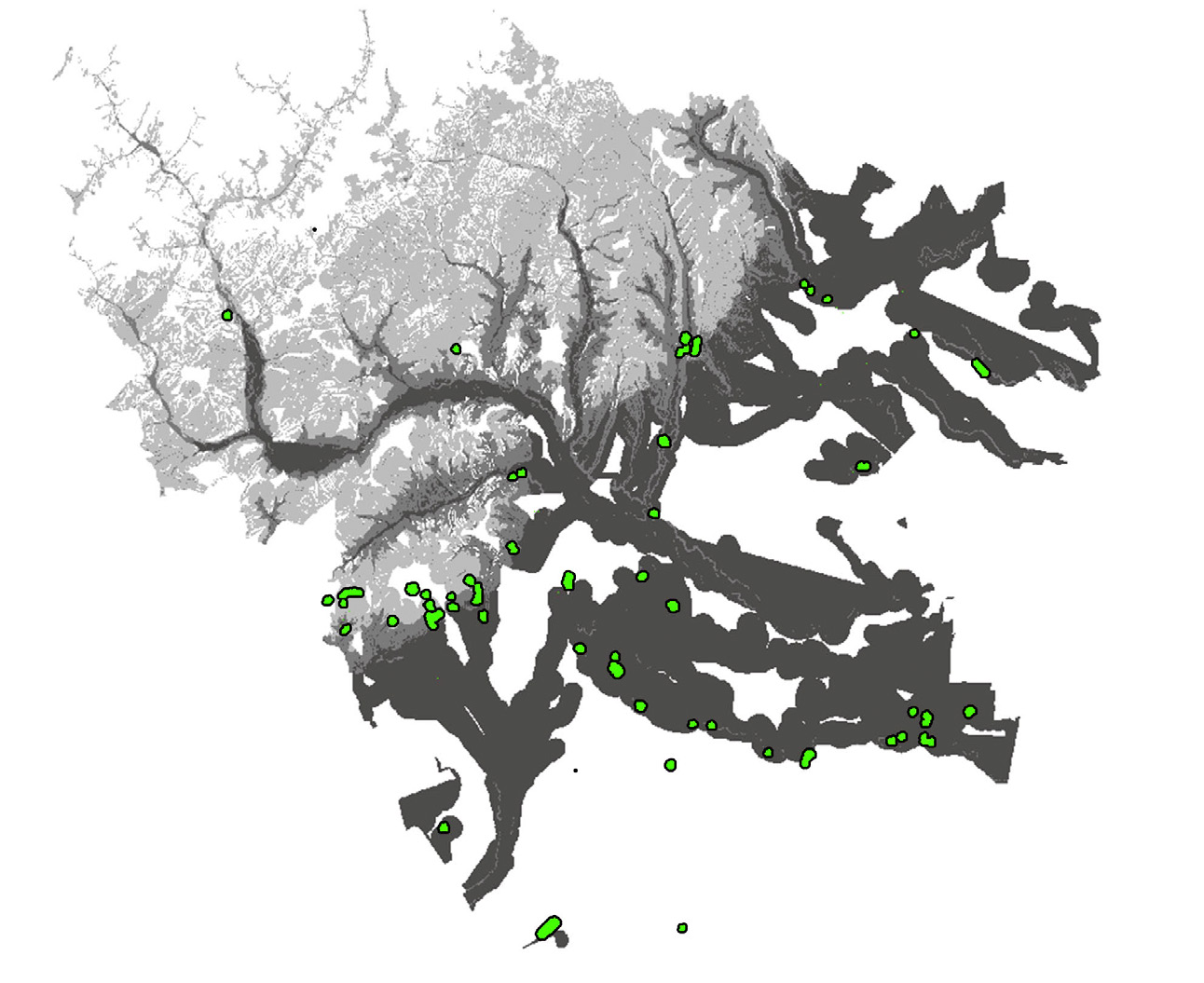
Fig. 1 – The relief and river network of the Buzău County. General emplacement o...
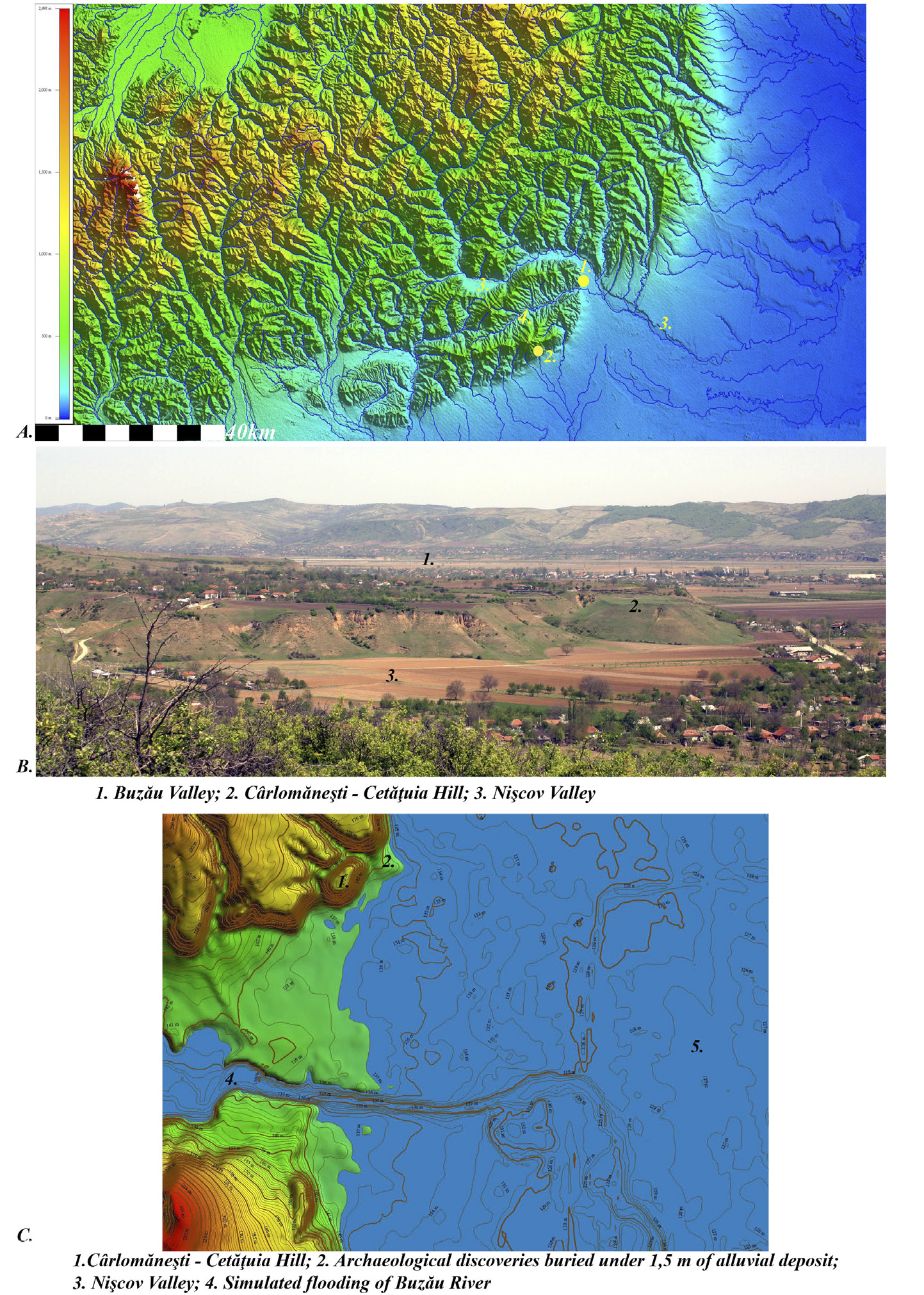
Fig. 2 – Archaeological site Cârlomăneşti-Cetăţuia, Buzău County.
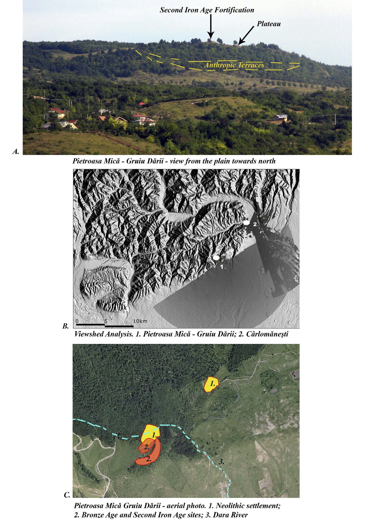
Fig. 3 – Archaeological site Pietroasa Mică-Gruiu Dării, Buzău County
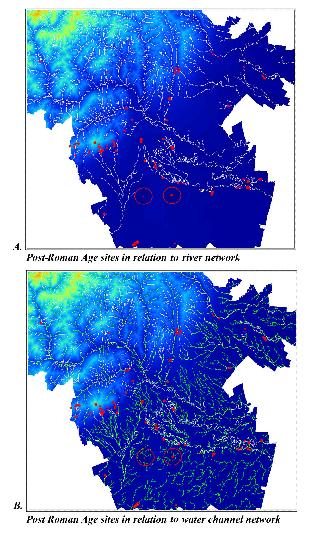
Fig. 4 – Detail of the Buzău County map showing the distribution of the Post-Rom...
Fig. 5 – Archaeological Predictive Model of the Buzău County for the Post-Roman ...
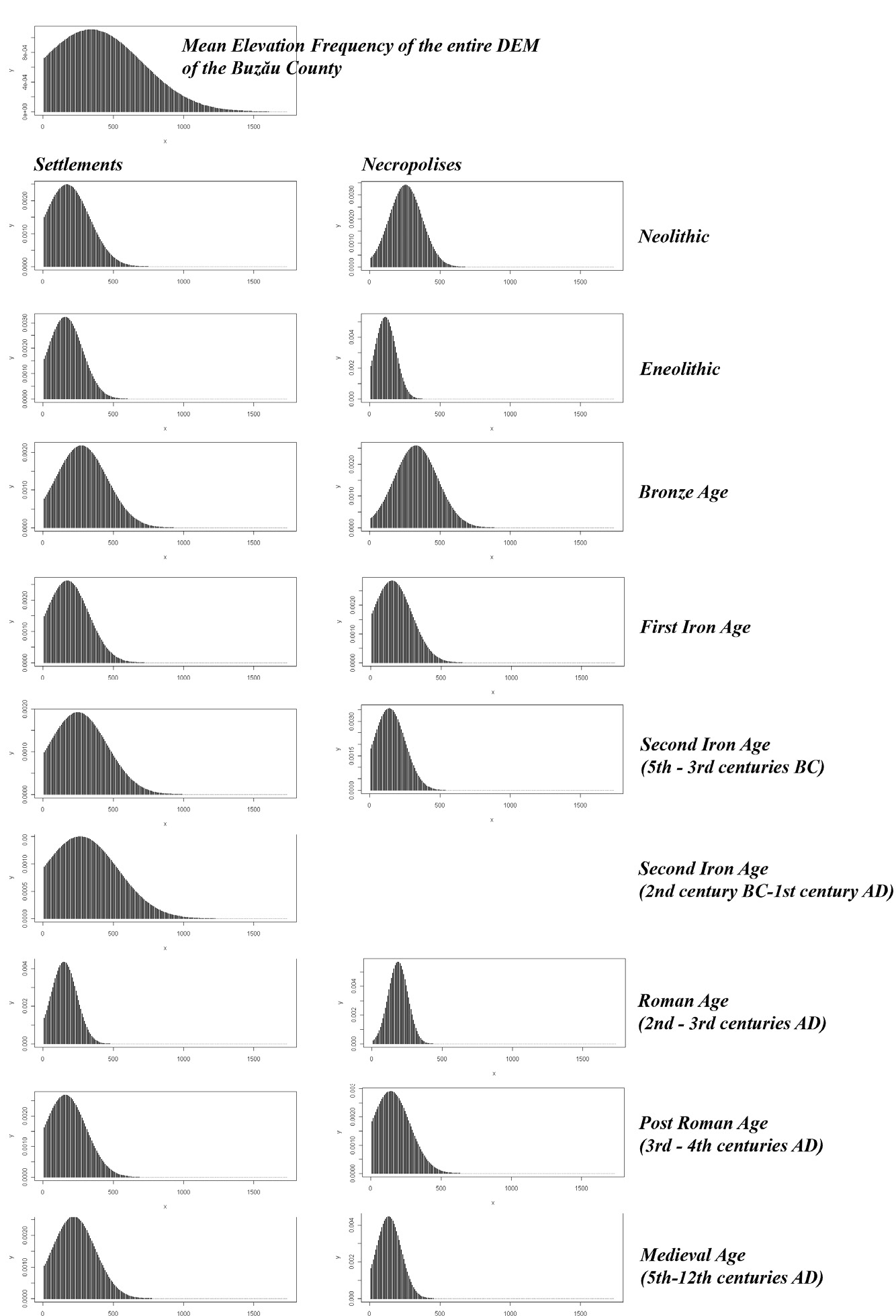
Fig. 6 – The normal distribution curves of mean elevation calculated for sites i...
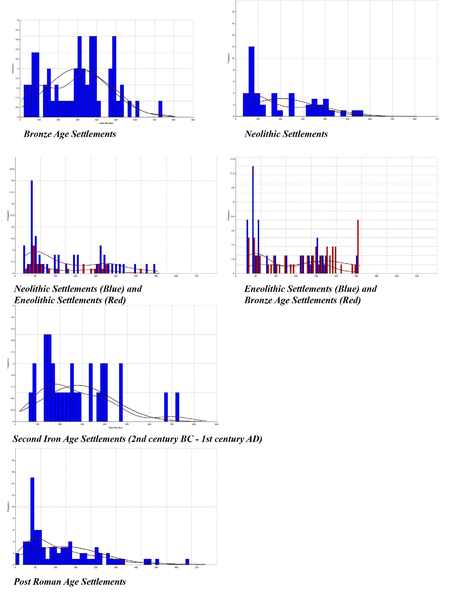
Fig. 7 – Histograms showing the frequency of mean elevation values for different...
Ştefan D., Sîrbu V. 2010, Statistical tools in Landscape Archaeology, Archeologia e Calcolatori 21