Volumes / Journal / 19 - 2008 / Héron C.
Click on any image to open slideshow
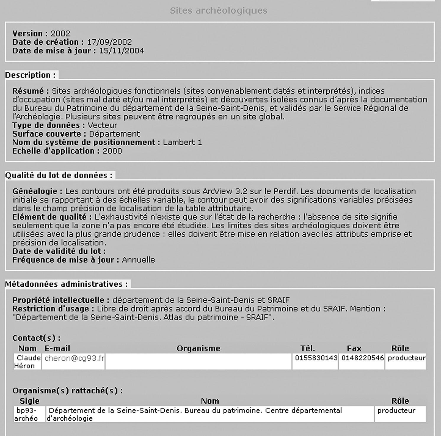
Fig. 1 – Geographic catalogue, metadata of the files (Département de la Seine-Sa...
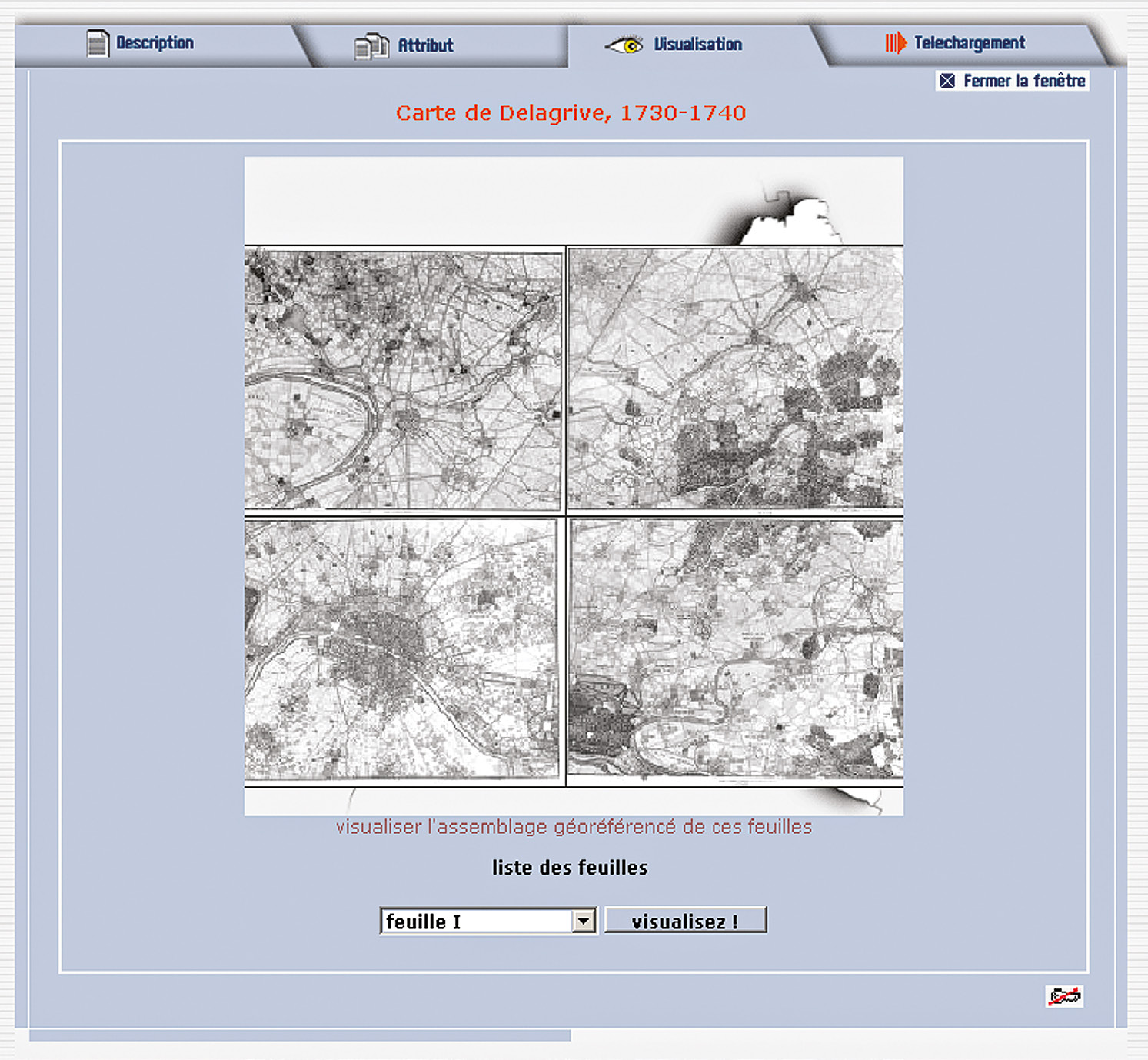
Fig. 2 – Geographic catalogue, visualization interface of the raster maps (Dépar...
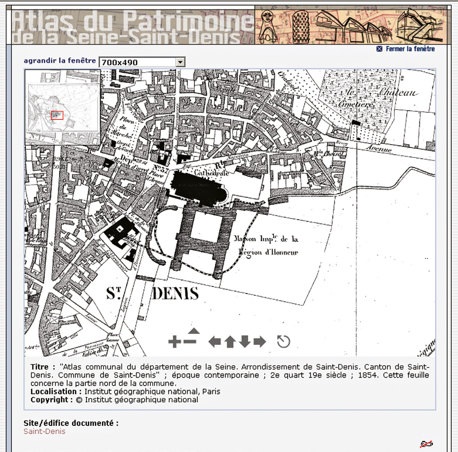
Fig. 3 – Geographic catalogue, visualization interface of the raster maps (Dépar...
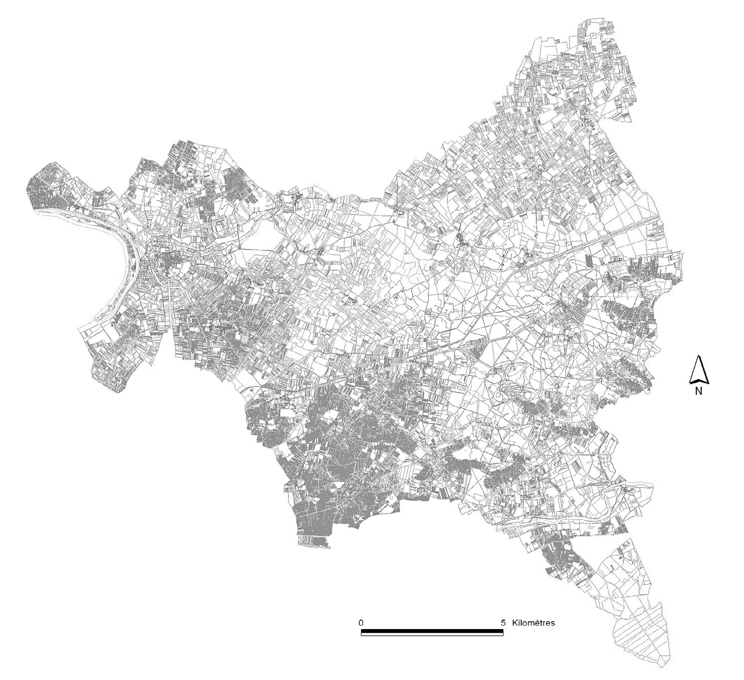
Fig. 4 – Vectorization of the Napoleonic cadastre, in the present state (Départe...
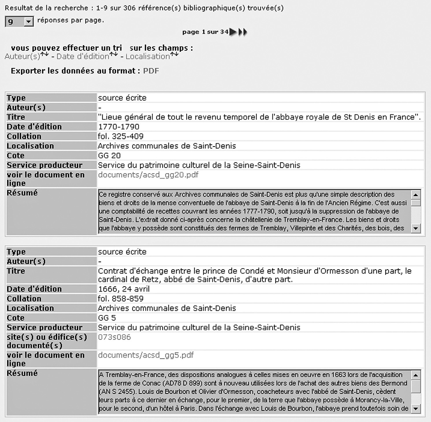
Fig. 5 – Bibliographic repertory, detail of the display of the results of a requ...
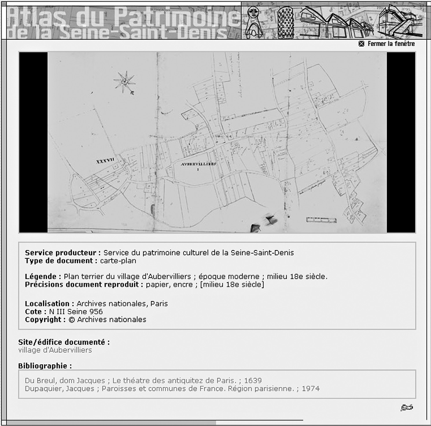
Fig. 6 – Iconographic catalogue, visualization interface of one of the pictures ...
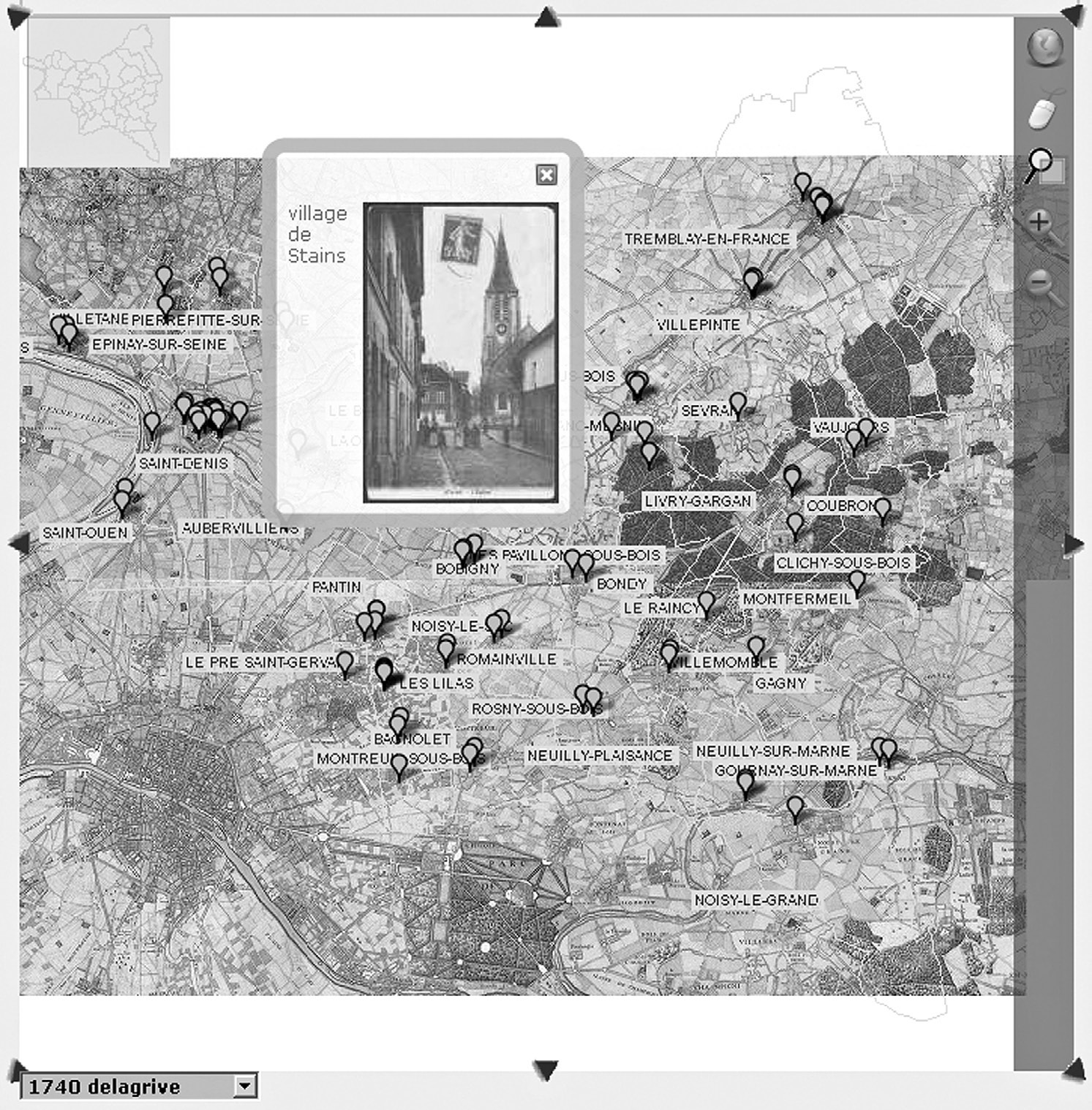
Fig. 7 – Repertory of the sites and buildings, detail of the display interface o...
Héron C. 2008, The Patrimony Atlas of Seine-Saint-Denis, Archeologia e Calcolatori 19