Volumes / Journal / 18 - 2007 / Semeraro G.
Click on any image to open slideshow
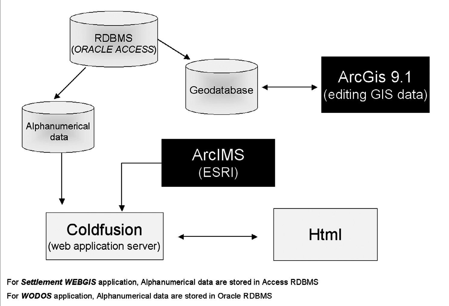
Fig. 1 – Software used for WebGIS.
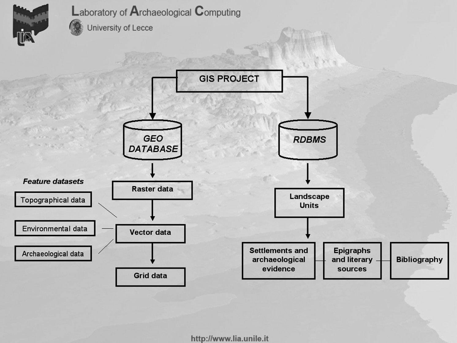
Fig. 2 – Settlement’s WebGIS: the data organization.
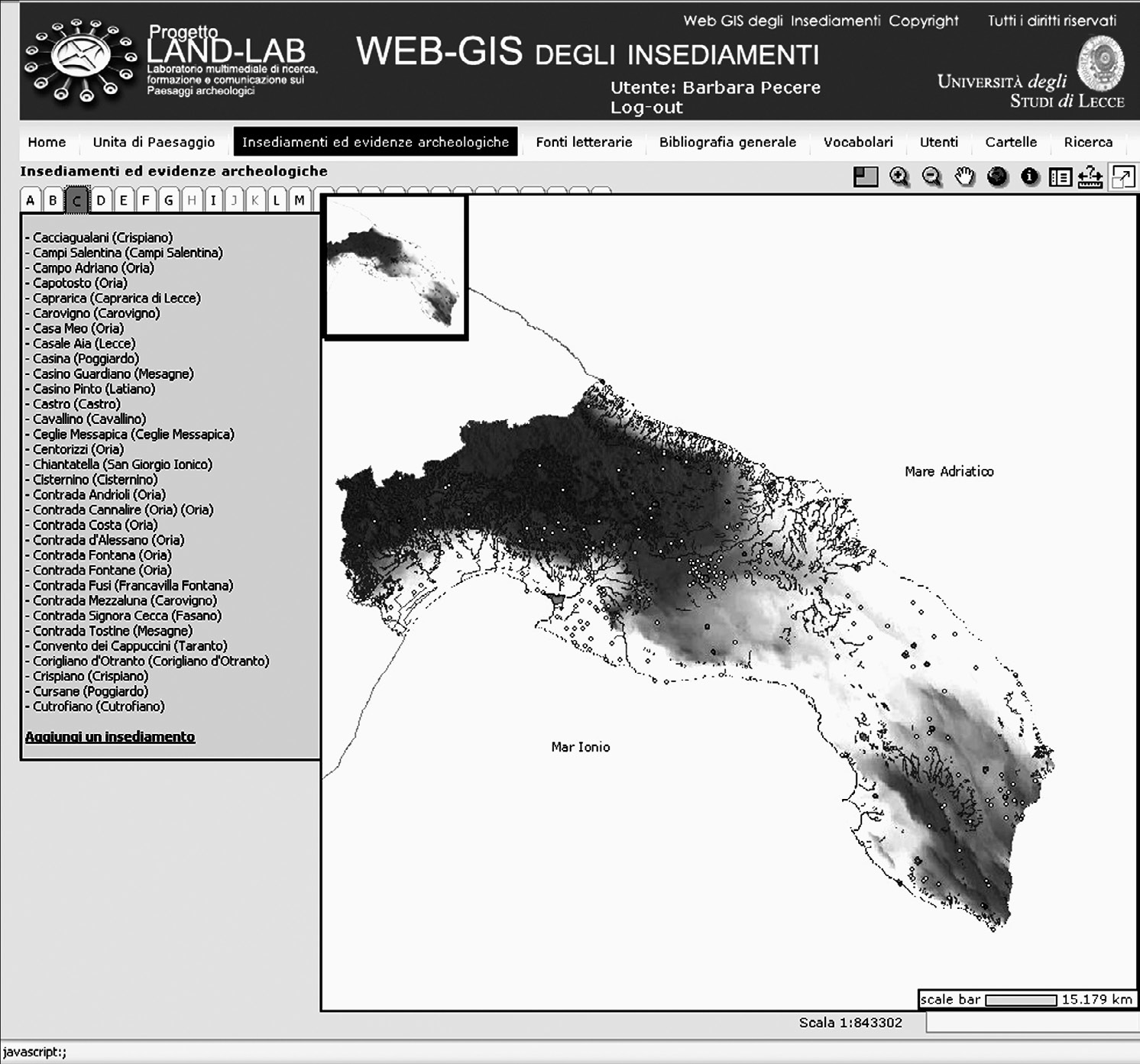
Fig. 3 – On-line GIS. Cartographical and alphanumerical contextual interface app...
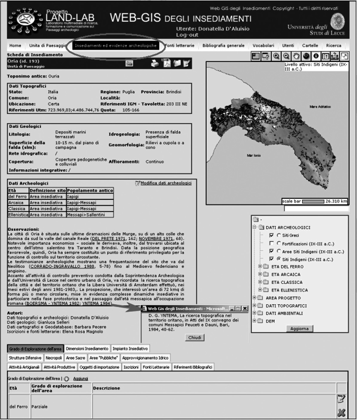
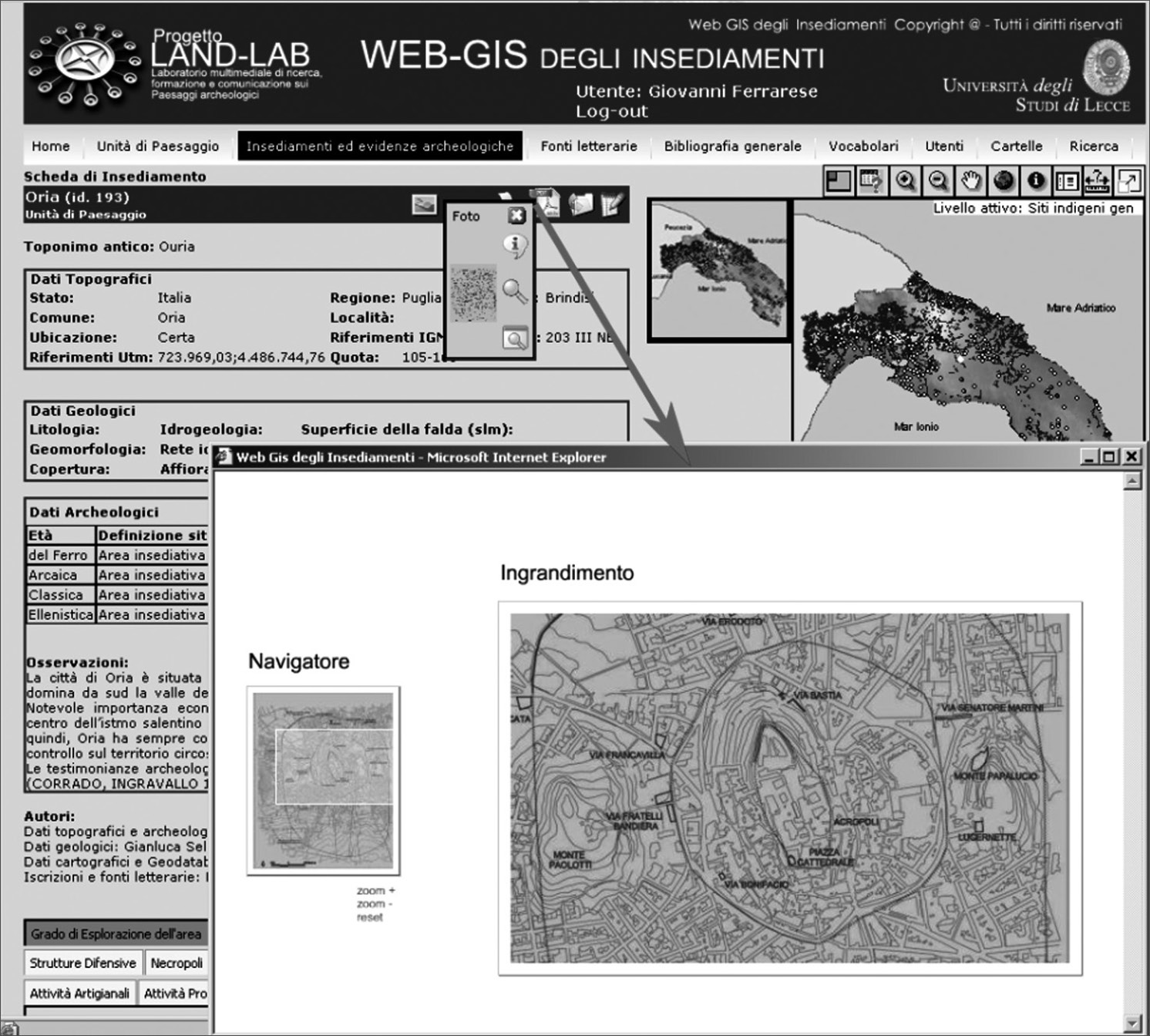
Fig. 4 – Settlement’s WebGIS: the site description file.
Fig. 5 – Settlement’s WebGIS: dynamic zoom.
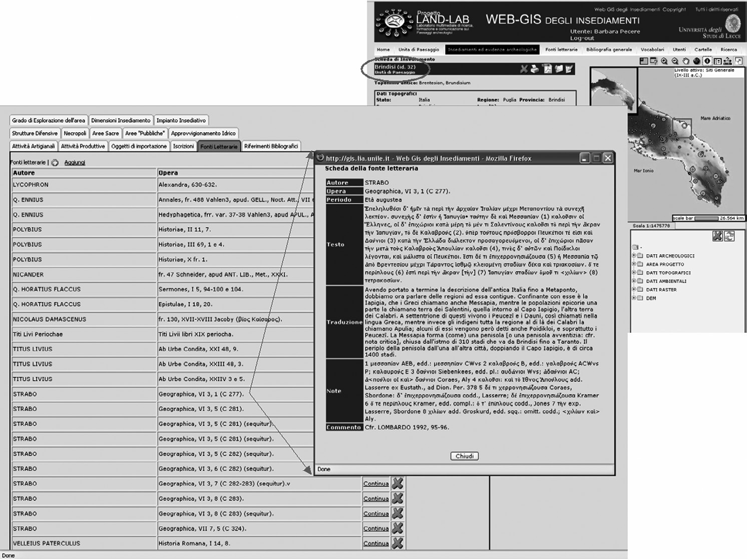
Fig. 6 – Settlement’s WebGIS: example of literary sources search.
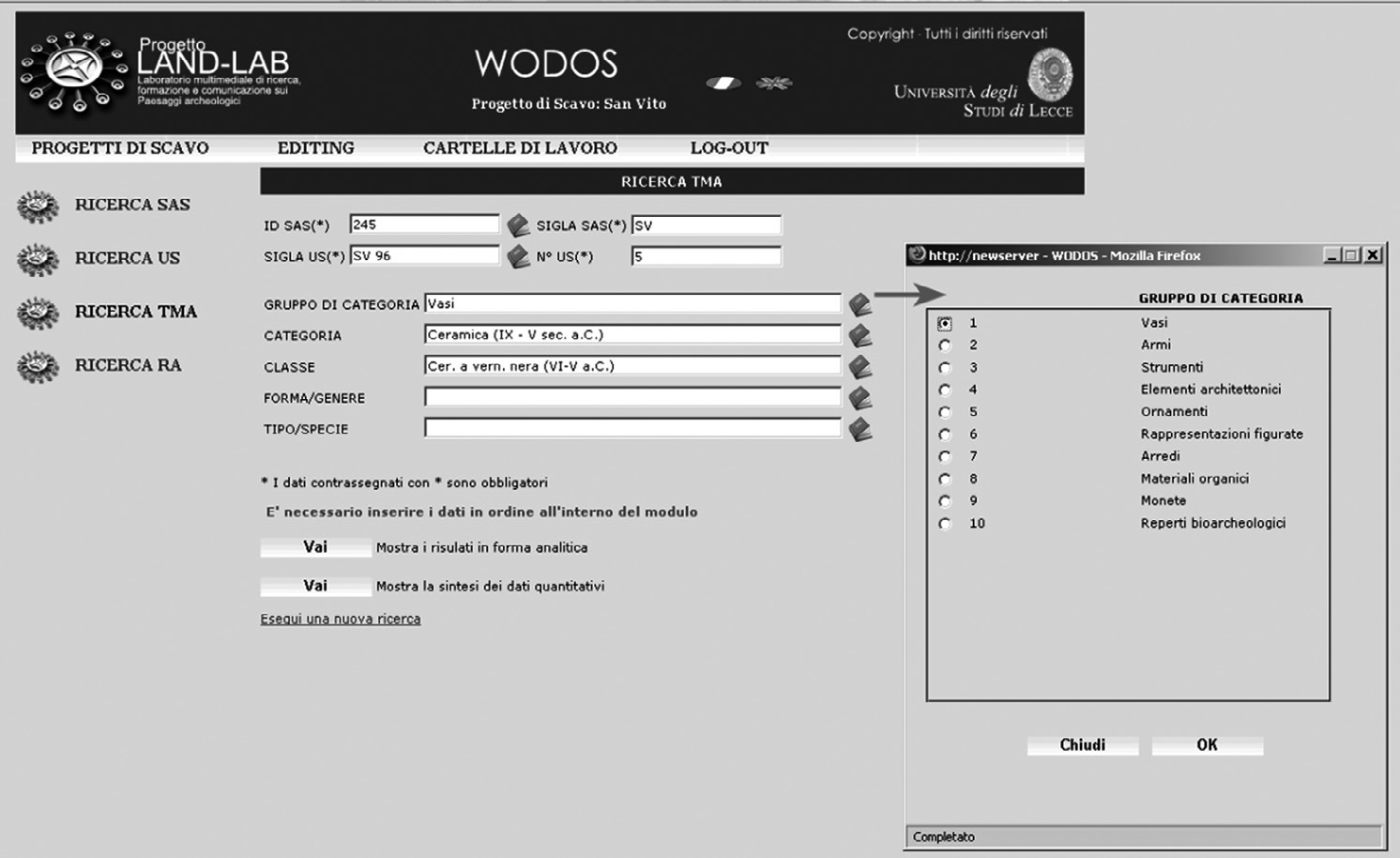
Fig. 7 – WODOS: TMA ‘search’ function.
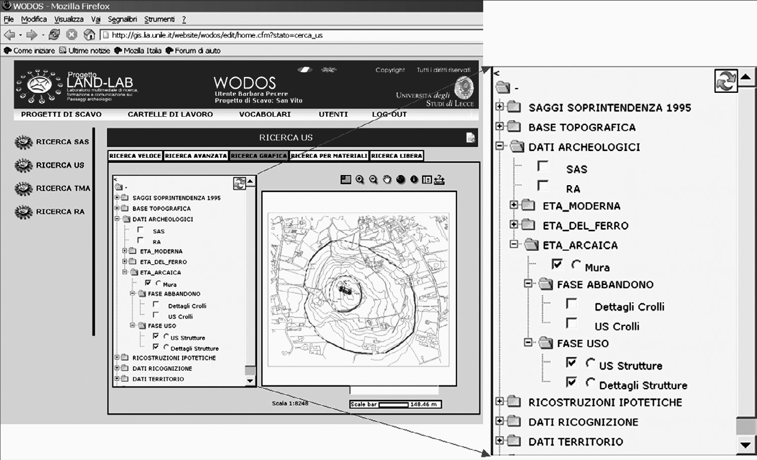
Fig. 8 – WODOS. Example of TOC (Table of Content).
Semeraro G. 2007, LandLab Project and archaeology on-line. Web-based systems for the study of settlement patterns and excavation data in classical archaeology, Archeologia e Calcolatori 18