IADI Image
Metadata
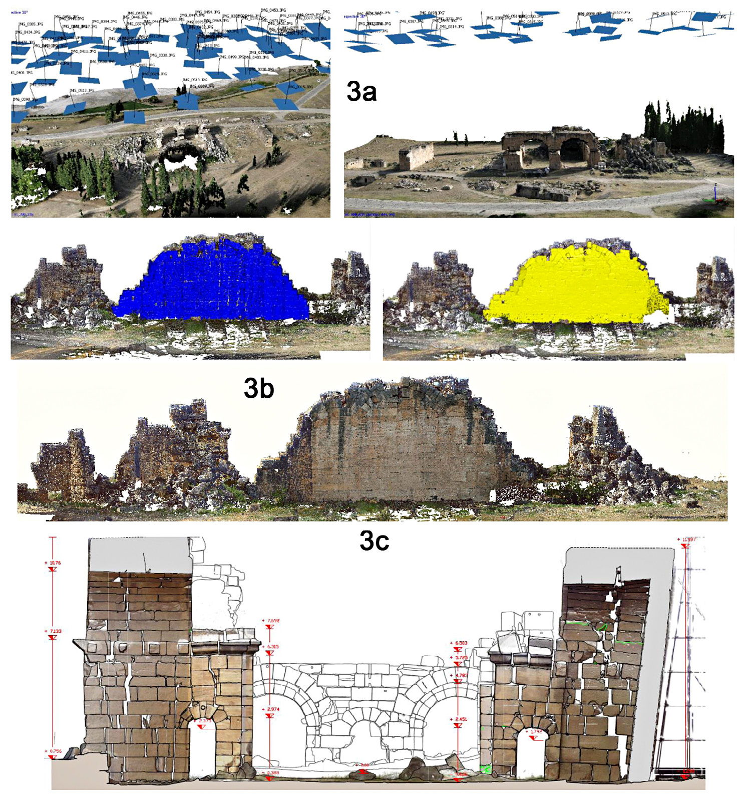
| Caption | a) 3D model from aerial photogrammetry in 2015 by Ebee flight: data is lacking in the area of the wall; b) LiDAR data with highlighted in blue the part concerning to the wall (sx) and in yellow (dx) the photogrammetric contribution of 2007 acquisition superimposed on the LiDAR data, in the central image beneath the data integration; c) Transversal section across the eastern wall. |
| Figure number | 3 |
| Article | Multi-temporal images and 3D dense models for archaeological site monitoring in Hierapolis of Phrygia (TK) |
| Authors | Chiabrando F., Sammartano G., Spanò A., Semeraro G. |
| Volume | Volume 28(2) |