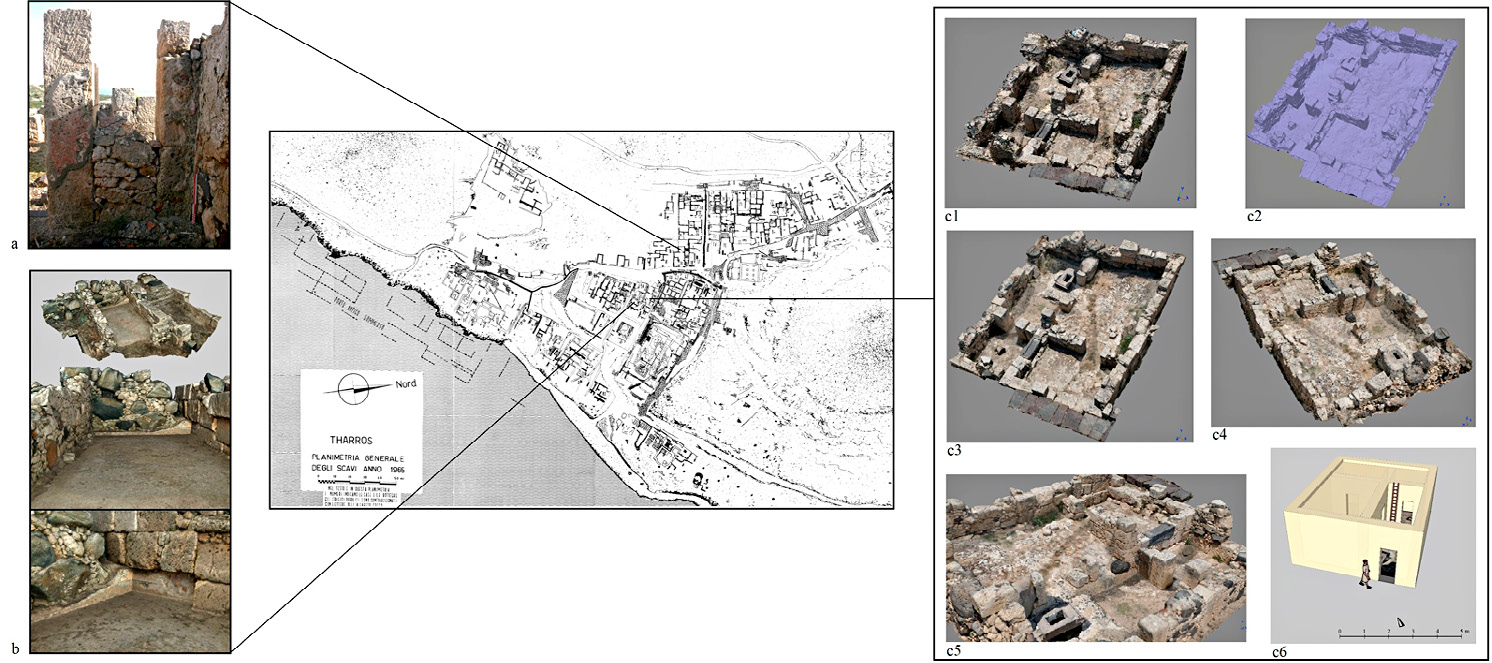
| Caption | Archaeological map of Tharros (Pesce 1966, Planimetria generale degli scavi anno 1965) with the contexts involved in 3D relief by laser scanner and photogrammetric method: a) Eastern wall of building no. 20 (photo by M. Marano); b) 3D model of building no. 58 (Marano, Silani in press); c) Point cloud (c1), mesh (c2), NW view of 3D model (c3), SW view of 3D model (c4), SE detail view of 3D model (c5) and reconstruction of the first phase (c6) of building no. 56. Data acquisition and processing: M. Marano. |
| Figure number | 4 |
| Article | Tharros - Capo San Marco in the
Phoenician and Punic Age. Geophysical
investigations and virtual rebuilding |
| Authors | Fariselli A., Boschi F., Silani M., Marano M. |
| Volume |
Volume 28(2)
|
| Pleiades places |
https://pleiades.stoa.org/places/472032 |
| Subjects |
| sites; architecture |
| archaeological sites; excavations; buildings |
| composition; maps; computer images |
| plans; virtual models |