IADI Image
Metadata
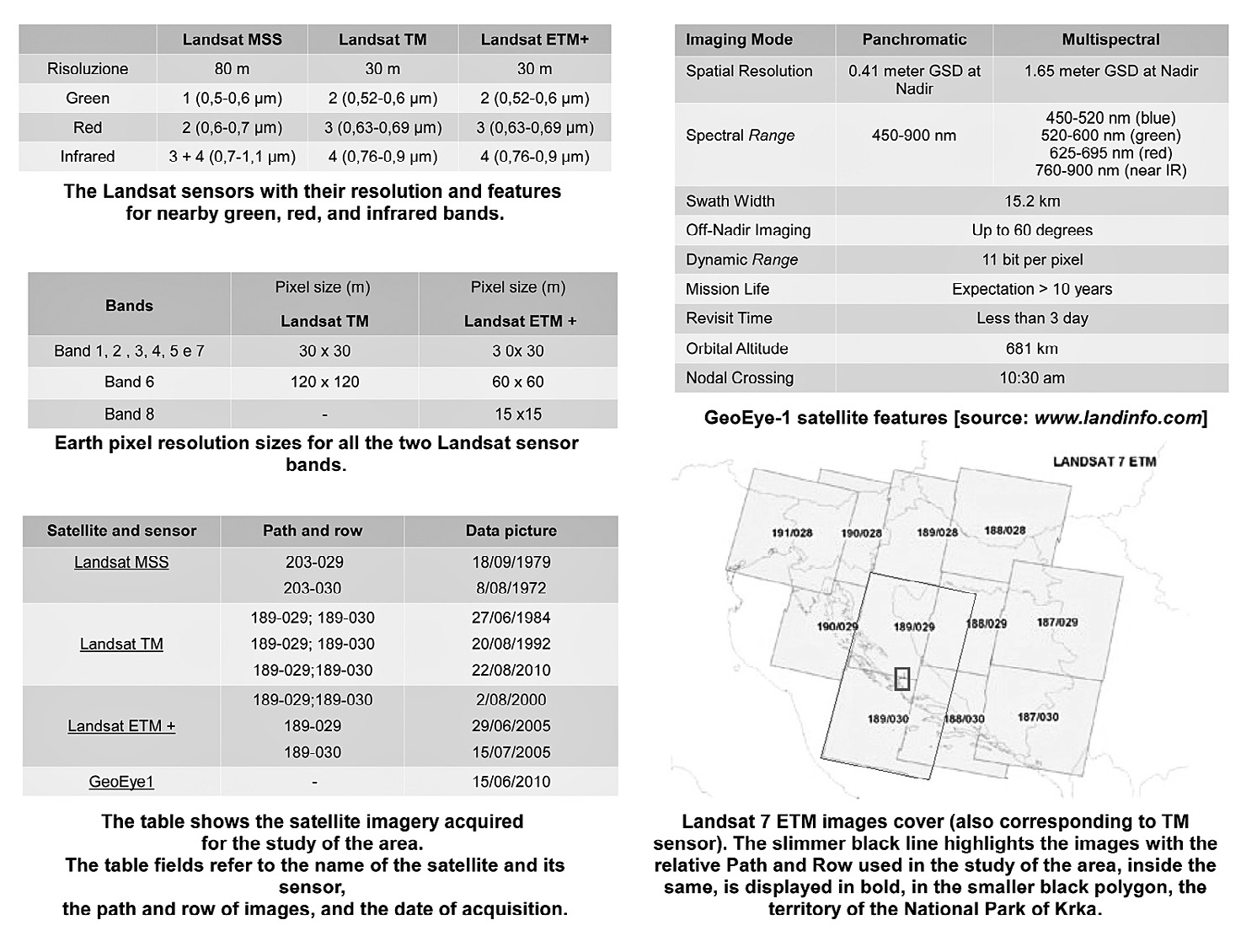
| Caption | Technical data of the satellite images used: Landsat images belong to an available archive at http://www.landcover.org/index.shtml, while the high resolution GeoEye-1 image has been acquired as a “demo” for search purposes from E-geos company (http://www.eurimage.com). |
| Figure number | 2 |
| Article | Geo-archaeological study of the territory of Burnum’s Roman site (Croatia) through LANDSAT multi-temporal satellite images and high resolution GeoEye |
| Authors | Campedelli A., Dubbini M., Monica M. |
| Volume | Volume 28(2) |