IADI Image
Metadata
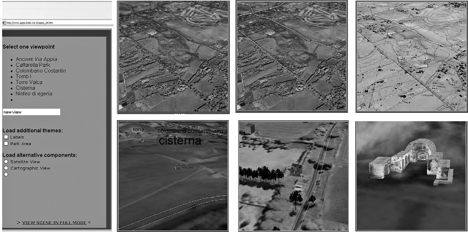
| Caption | Appia Archaeological Park VR webGIS application (www.appia.itabc.cnr.it). Through the menu the visitor can deconstruct the landscape analyzing different components and source data (satellite images, cartographic maps, vector layers, 3D models, vegetation, etc.) (Pescarin et al. 2005). |
| Figure number | 4 |
| Article | The virtual museum of landscape |
| Authors | Forte M., Pescarin S. |
| Volume | Volume 1 |