IADI Image
Metadata
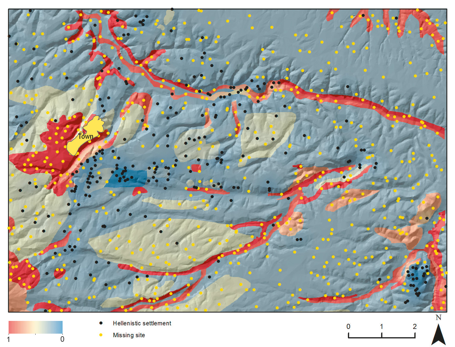
| Caption | Trend surface created for the allocation of missing sites (probability from 0 to 1), and the simulated “complete” early colonial settlement distribution (262 recorded settlements plus 600 missing sites, therefore 862 sites in total). The raster base map is the shaded relief calculated from the 10 m-resolution DEM named TINITALY/01 (Tarquini et al. 2007, 2012; Tarquini, Nannipieri 2017). Figure by the author. |
| Figure number | 4 |
| Article | A method for modeling dispersed settlements: visualizing an early Roman colonial landscape as expected by conventional theory |
| Authors | Casarotto A. |
| Volume | Volume 28(1) |