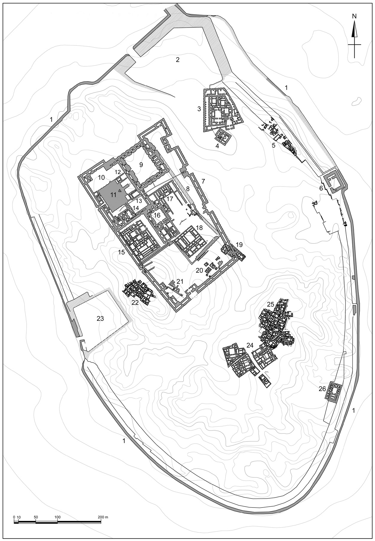
| Caption | General plan of the city (drawn up by F. Ghio): 1, CityWall; 2, North Harbour; 3, Palace of Ennigaldi-Nanna; 4, HarbourTemple; 5, Houses on CityWall; 6, Kassite Fort; 7, Enclosure of the Sacred Area in the neo-Babylonian period; 8, Enclosure of the Sacred Area during the 3rd Dynasty; 9, Nanna Court; 10, Etemenniguru; 11, Ziggurat; 12, NannaTemple; 13, Boat Shrine; 14, NingalTemple; 15, Giparku; 16 Edublamakh; 17, Ganunmakh; 18, Ekhursag; 19, Mausolea of the 3rd Dynasty; 20, Royal Graves; 21, NimintabbaTemple; 22, Houses (EM District); 23,West Harbour; 24, Houses (AH District); 25, Neo-Babylonian Houses; 26, EnkiTemple. |