IADI Image
Metadata
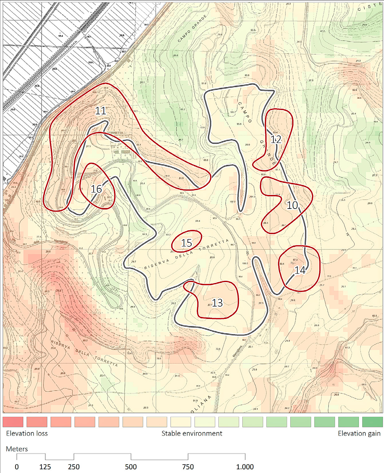
| Caption | The differential digital elevation model acquired from the comparison of elevation data of 1961 and 2002. |
| Figure number | 8 |
| Article | A hand to the plough. A GIS-based cartographical analysis of changes in elevation due to terrain modification and erosion in the settlement area of ancient Crustumerium |
| Authors | Seubers J., Trienen T. |
| Volume | Volume 26 |