IADI Image
Metadata
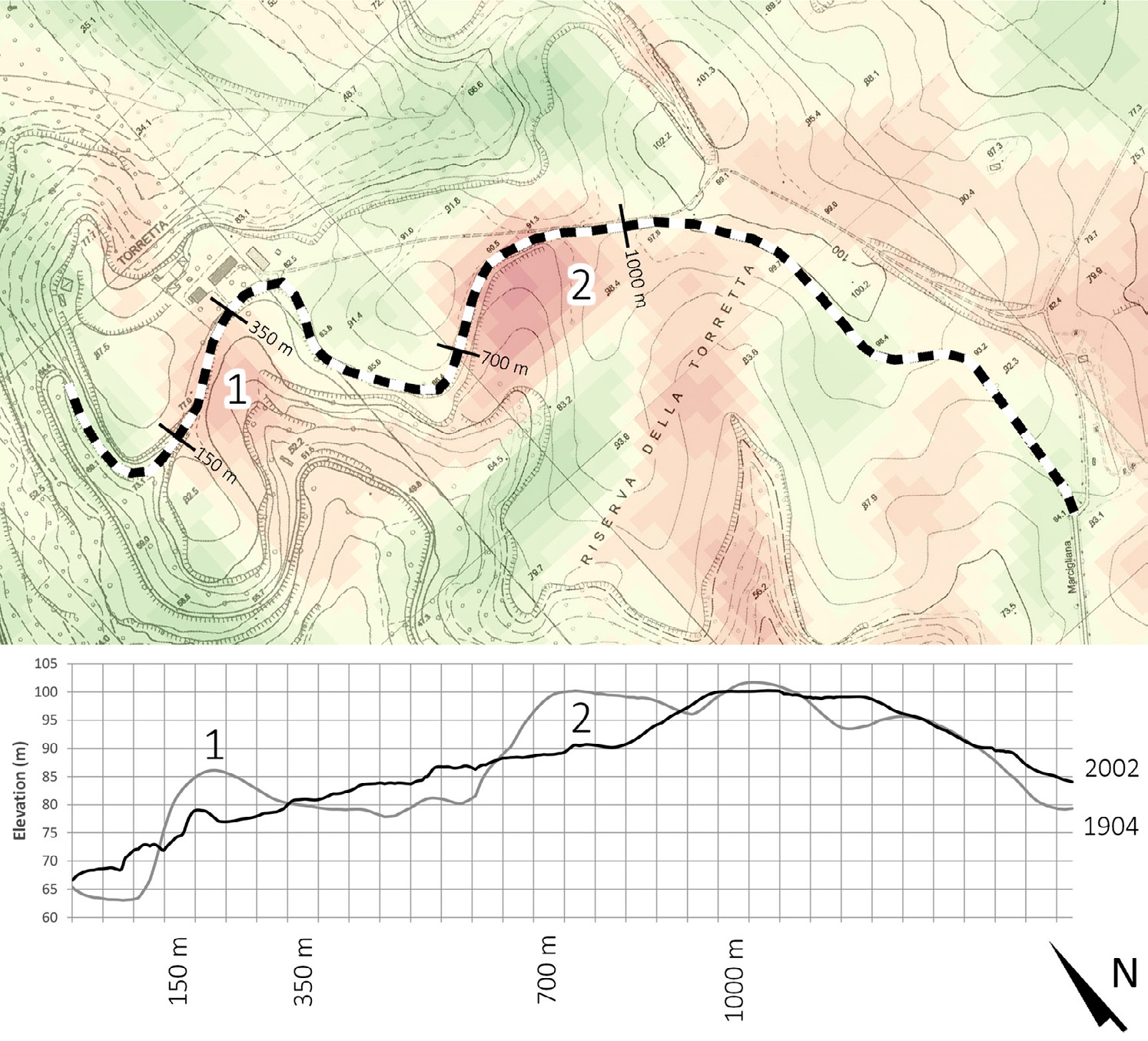
| Caption | A comparison of the elevation values along the trajectory of the Via della Marcigliana in the pre-bonifica landscape of 1904 and the modern landscape of 2002. |
| Figure number | 7 |
| Article | A hand to the plough. A GIS-based cartographical analysis of changes in elevation due to terrain modification and erosion in the settlement area of ancient Crustumerium |
| Authors | Seubers J., Trienen T. |
| Volume | Volume 26 |